
Weather on This Date - October 25
Entry posted by admin
451 views

October 25, 1921
A hurricane with 100 mph winds hit Tampa, FL, causing several million dollars damage. (David Ludlum)
October 25, 1977
Dutch Harbor in Alaska reported a barometric pressure reading of 27.31 inches (925 millibars) to establish an all-time record for the state. (The Weather Channel)
October 25, 1981
A northbound tornado caused two million dollars damage to Bountstown, FL, in less than five minutes. Fortunately no deaths occurred along its six mile path, which was 30 to 100 yards in width. Radar at Apalachicola had no indication of a tornado or severe weather. (The Weather Channel)
October 25, 1987
A storm system moving across the Saint Lawrence Valley produced 40 to 50 mph winds east of Lake Ontario. High winds downed some trees around Watertown NY, and produced waves seven feet high between Henderson Harbor and Alexandria Bay. Mason City IA and Waterloo IA tied for honors as cold spot in the nation with record lows for the date of 19 degrees. Severe thunderstorms in Oklahoma and northern Texas produced golf ball size hail and wind gusts to 65 mph. (The National Weather Summary) (Storm Data)
October 25, 1988
Severe thunderstorms erupted over northeastern Texas during the late evening producing softball size hail at Newcastle and Jonesboro. Low pressure over James Bay in Canada continued to produced showers and gale force winds in the Great Lakes Region. (The National Weather Summary) (Storm Data)
October 25, 1989
Low pressure over Nevada produced high winds in the southwestern U.S., and spread heavy snow into Utah. Winds gusted to 63 mph at the Mojave Airport in southern California. Snowfall totals in Utah ranged up to 12 inches at Snowbird, with 11 inches at Alta. "Indian Summer" type weather continued in the central and eastern U.S. Twenty cities in the north central U.S. reported record high temperatures for the date. Highs of 77 degrees at Alpena MI and 81 degrees at Saint Cloud MN were the warmest of record for so late in the season. (The National Weather Summary) (Storm Data)
October 25, 2010
Severe weather was widespread across north and central Georgia. An EF-1 tornado tracked for a little over 4 miles in Dade County from Sulphur Springs Station to Rising Fawn. Thirty homes sustained minor roof damage, two barns were destroyed and a mobile home lost nearly its entire roof. An EF-0 tornado briefly touched down in Catoosa County northeast of Ringgold. Two homes, two chicken houses and a barn sustained minor roof damage. (NWS Atlanta)
Data courtesy of WeatherForYou
TODAY'S WEATHER SUMMARY
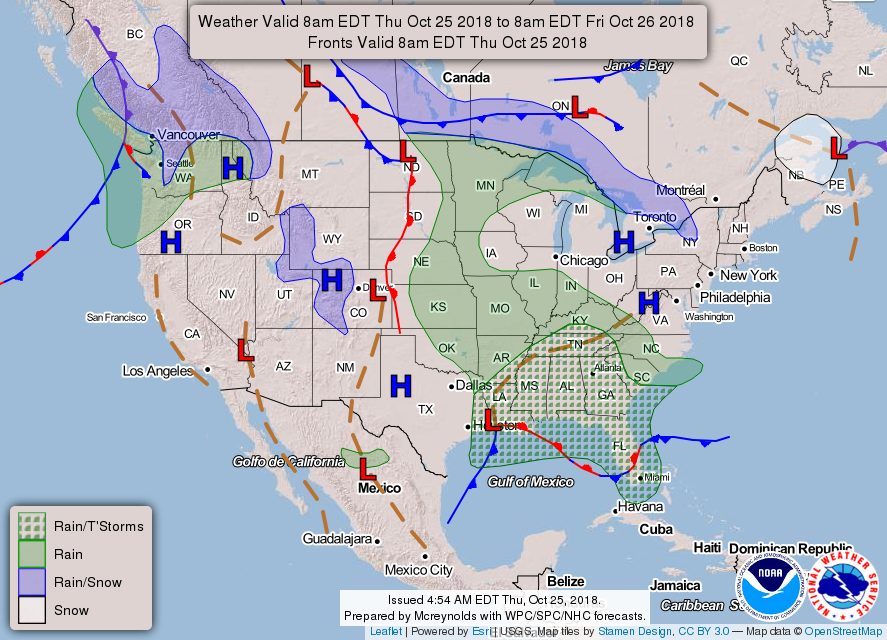
Today's Weather Map
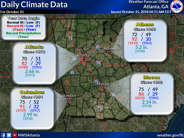
Today's Climate Records and Averages

Astronomical Information for Today - Accurate for Gwinnett County GA
5:00 AM TEMPS AND DEW POINTS
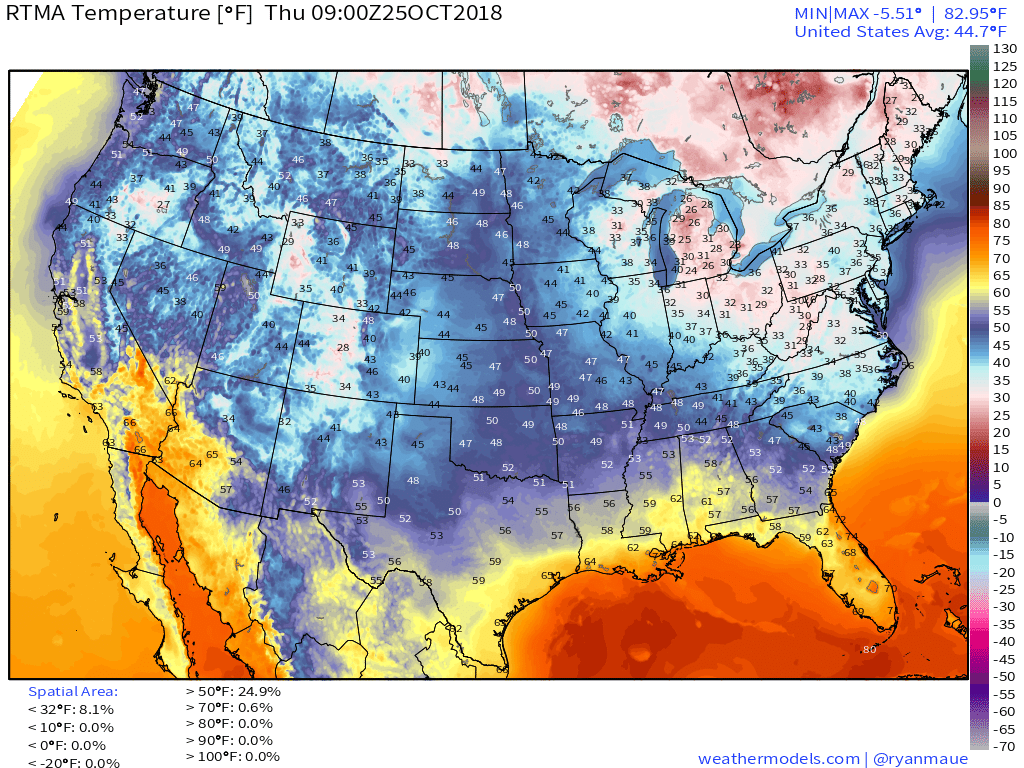
Temperatures
|
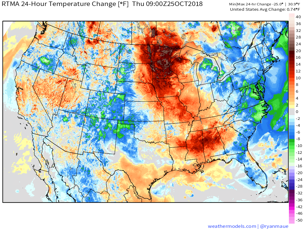
24 Hour Temperature Change
|
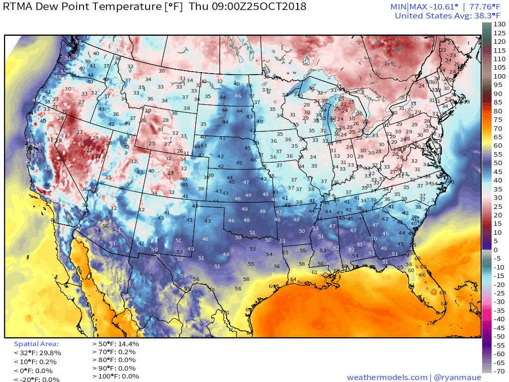
Dew Points
|
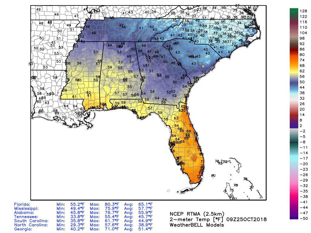
Southeast Temperatures
TODAY'S FORECAST
TEMPERATURES
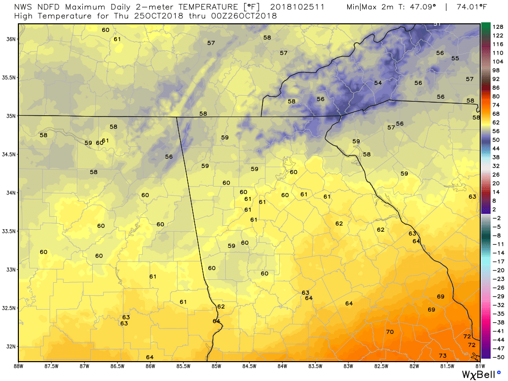
High Temps
|
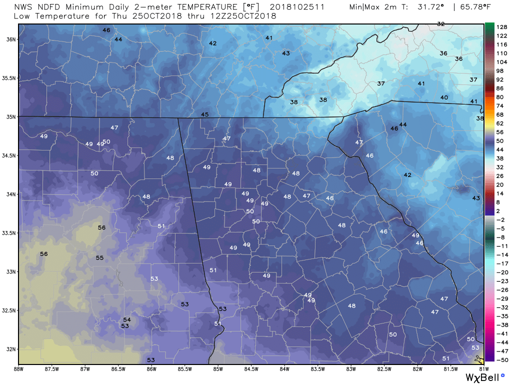
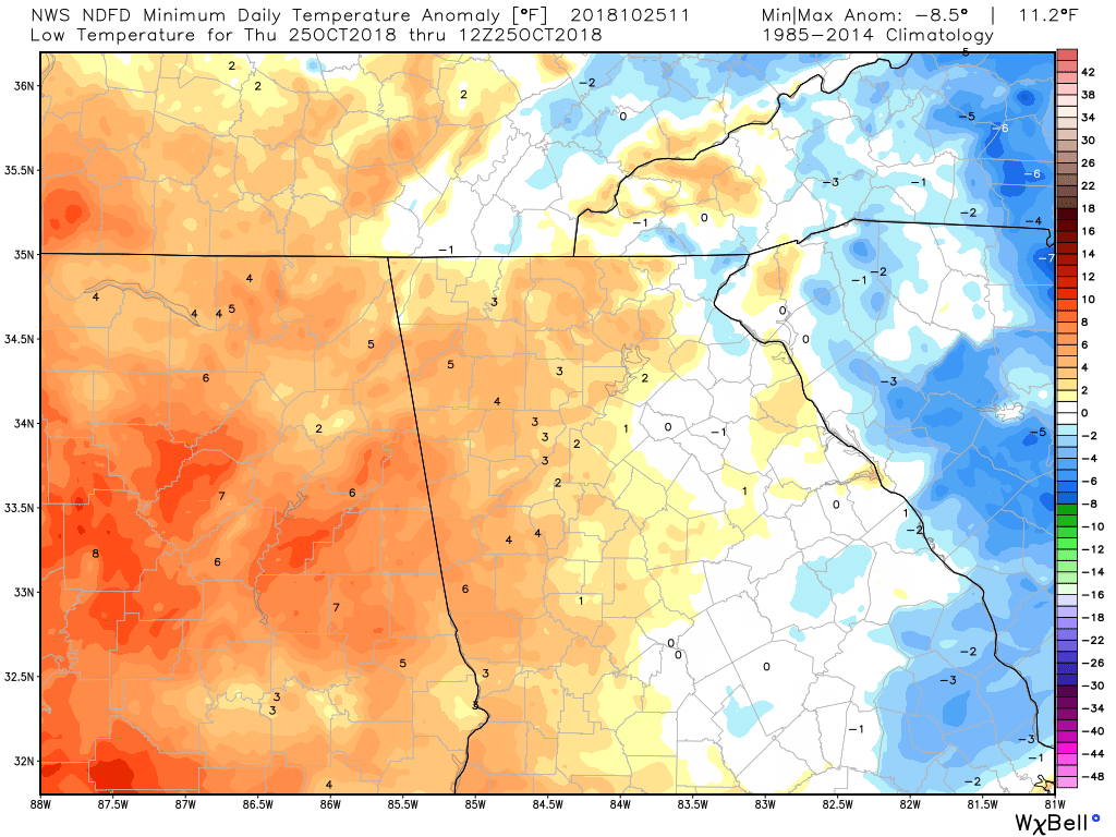
Low Temps
|
TEMPERATURE ANOMALIES
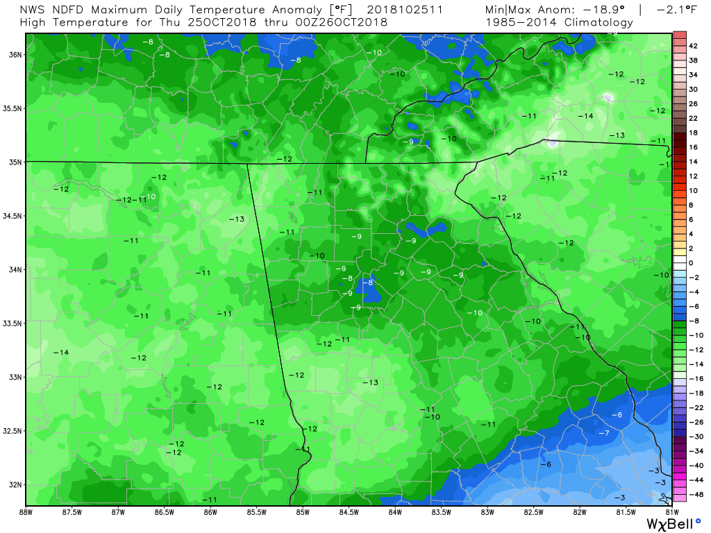
High Temp Anomalies
|
Max Wind Gust
|
WIND
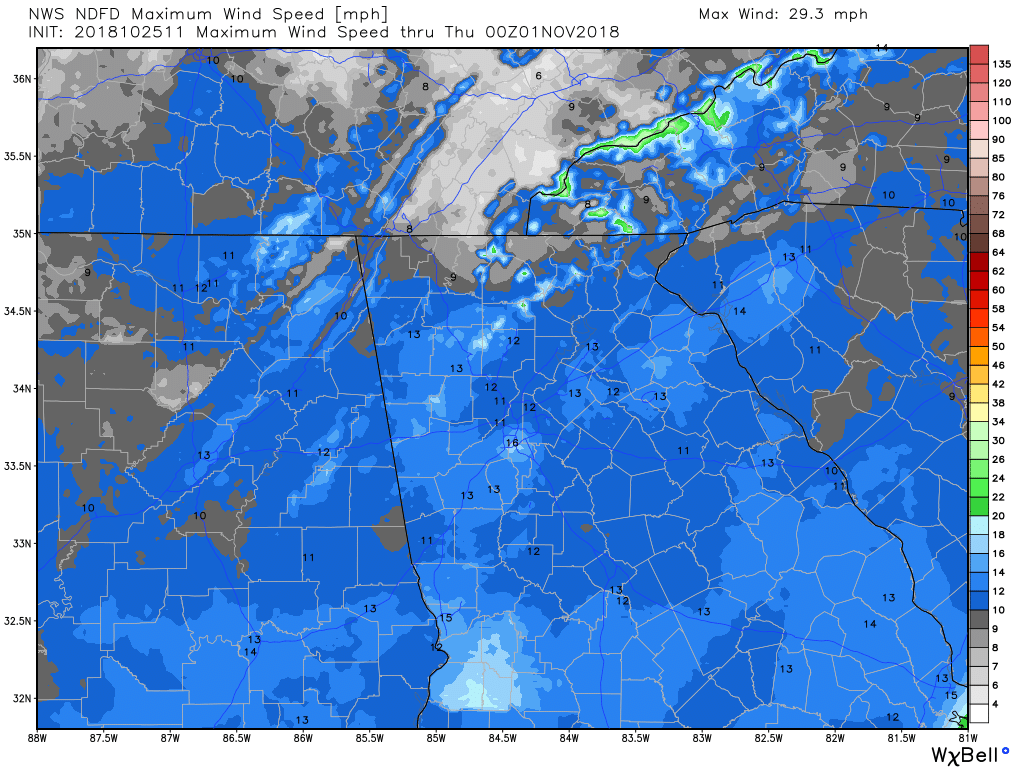
Max Wind Speed
|

Max Wind Gust
|
PRECIPITATION
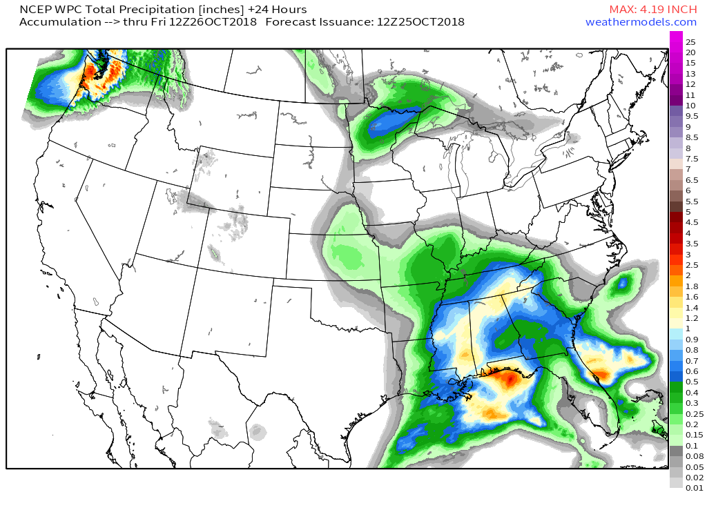
WPC - 24 Hour Precipitation Forecast
|
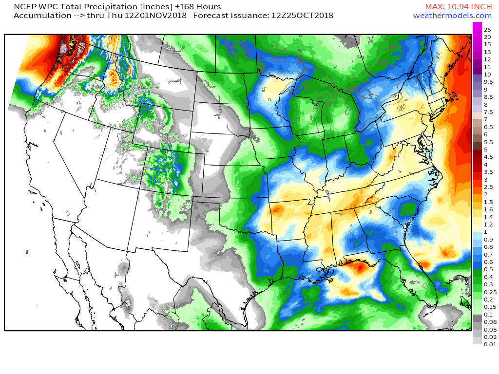
WPC - 7 Day Precipitation Forecast
|

0 Comments
Recommended Comments
There are no comments to display.