
Weather on This Date - November 4

Entry posted by NorthGeorgiaWX
905 views

November 4, 1927
A great Vermont flood occurred. Tropical rains deluged the Green Mountain area of Vermont causing the worst flood in the history of the state. Torrential rains, up to 15 inches in the higher elevations, sent streams on a rampage devastating the Winooski Valley. Flooding claimed 200 lives and caused 40 million dollars damage. The town of Vernon reported 84 deaths. Flooding left up to eight to ten feet of water in downtown Montpelier VT. (2nd-4th) (David Ludlum) (The Weather Channel)
November 4, 1985
A super wet Gulf storm dumped upwards of fifteen inches of rain in the mountains of Virginia and West Virginia causing devastating damage and claiming forty lives. (Sandra and TI Richard Sanders - 1987)
November 4, 1987
Thirty-two cities in the eastern and south central U.S. reported record high temperatures for the date. Highs of 74 degrees at Portland ME and 86 degrees at Fort Smith AR equaled November records. It was the fourth day of record warmth for Beckley WV, Memphis TN and Paducah KY. A cold front ushered much colder air into the north central U.S. Gale force winds lashed all five Great Lakes. (The National Weather Summary)
November 4, 1988
Thunderstorms developing ahead of a fast moving cold front produced severe weather over the Tennessee Valley and the Central Gulf Coast States during the afternoon and evening hours, and into the next morning. Thunderstorms spawned nineteen tornadoes, including eleven in Mississippi. The last of the nineteen tornadoes killed a woman in her mobile home in Lee FL. A tornado in Culbert AL injured sixteen people, and caused two million dollars damage. Thunderstorms also produced baseball size hail in Alabama. Unseasonably hot air prevailed south of the cold front. McAllen TX was the hot spot in the nation with a high of 102 degrees. (The National Weather Summary) (Storm Data)
November 4, 1989
Snow and high winds plagued parts of Colorado and Wyoming. Winds gusted to 71 mph near Wheatland WY, and reached 80 mph west of Fort Collins CO. Up to five inches of snow blanketed Yellowstone Park WY closing many roads. Snow also blanketed northern Minnesota, with seven inches reported at Baudette. (The National Weather Summary) (Storm Data)
November 4, 1991
Winter-like temperatures produced considerable crop damage over Sumter County. Overnight lows dropped into the mid to upper 20's the mornings of November 4th, 5th and 6th with daytime highs in the 50's. Damages to crops, including cucumbers, green beans, peanuts and squash were estimated at $1 million. (NWS Atlanta)
Data courtesy of WeatherForYou
TODAY'S WEATHER SUMMARY
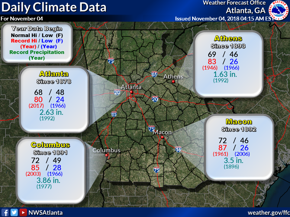
Today's Climate Records and Averages
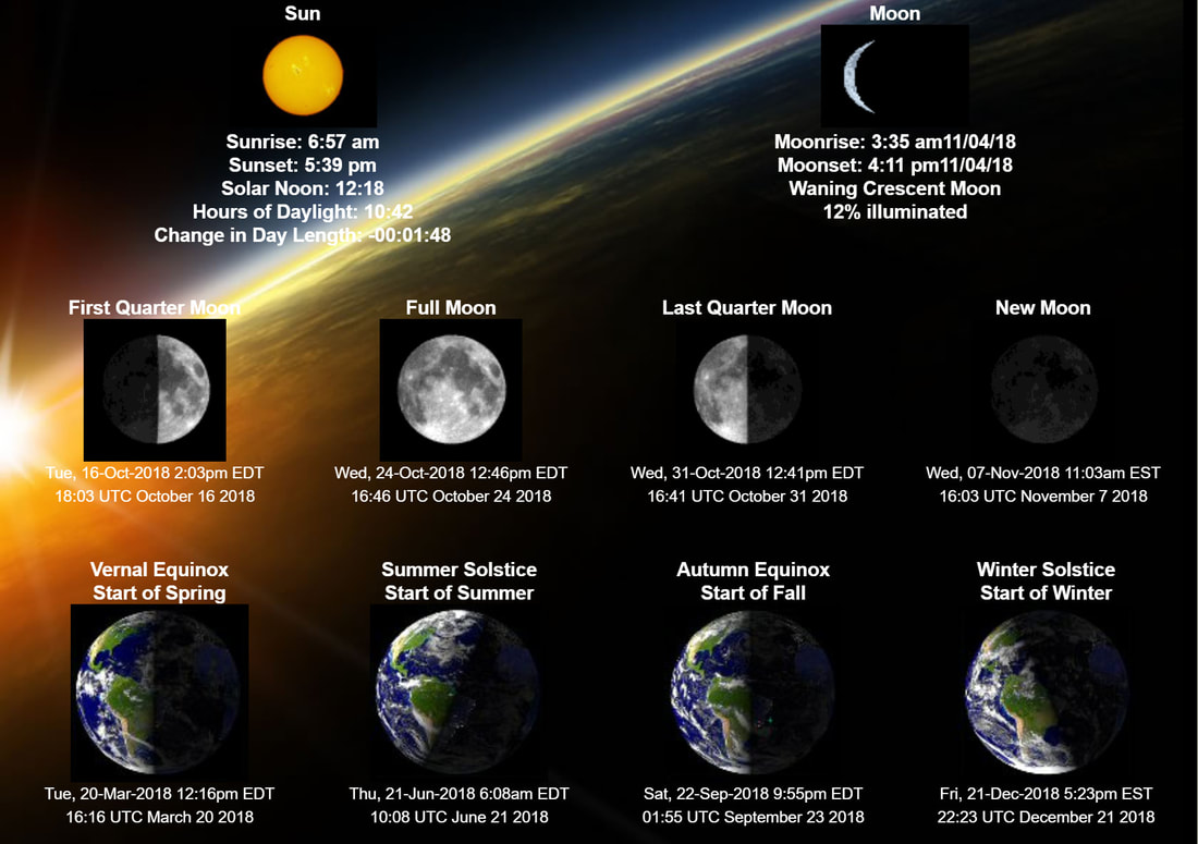
Astronomical Information for Today - Accurate for Gwinnett County GA
5:00 AM TEMS, DEW POINTS, and WIND CHILL
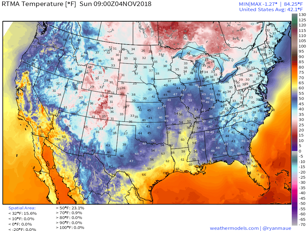
Temperatures
|

24 Hour Temp Change
|
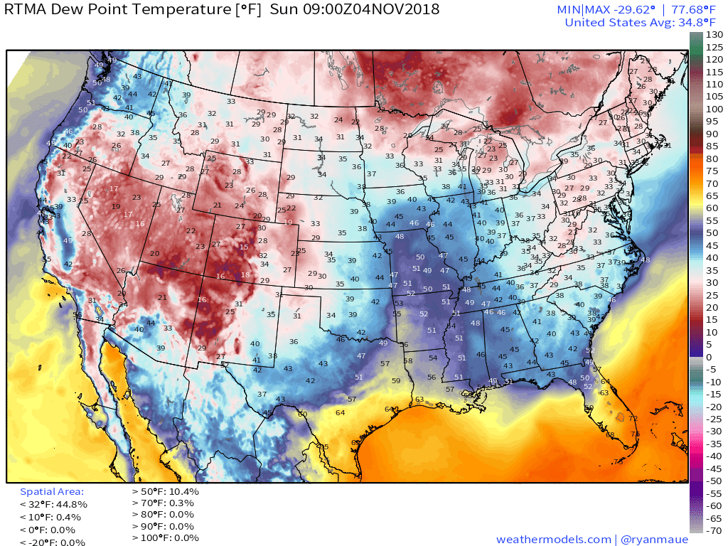
Dew Points
|
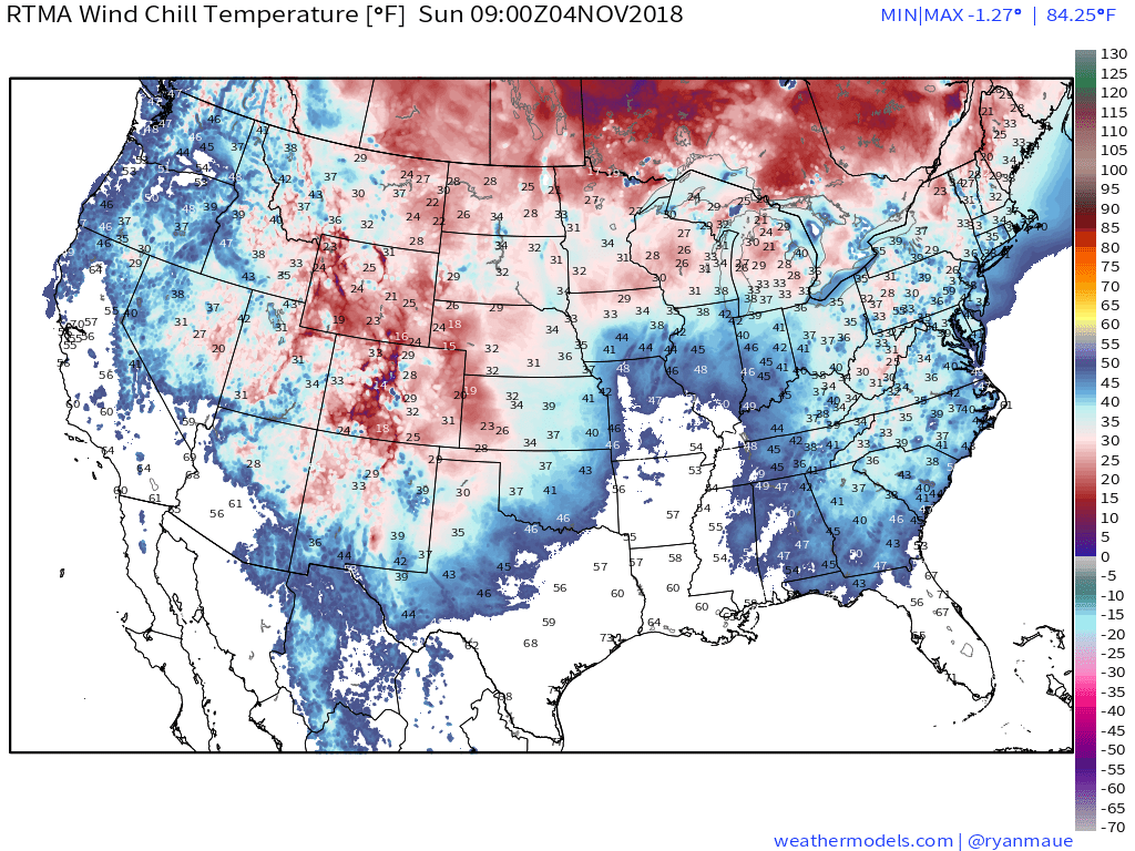
Wind Chill
|
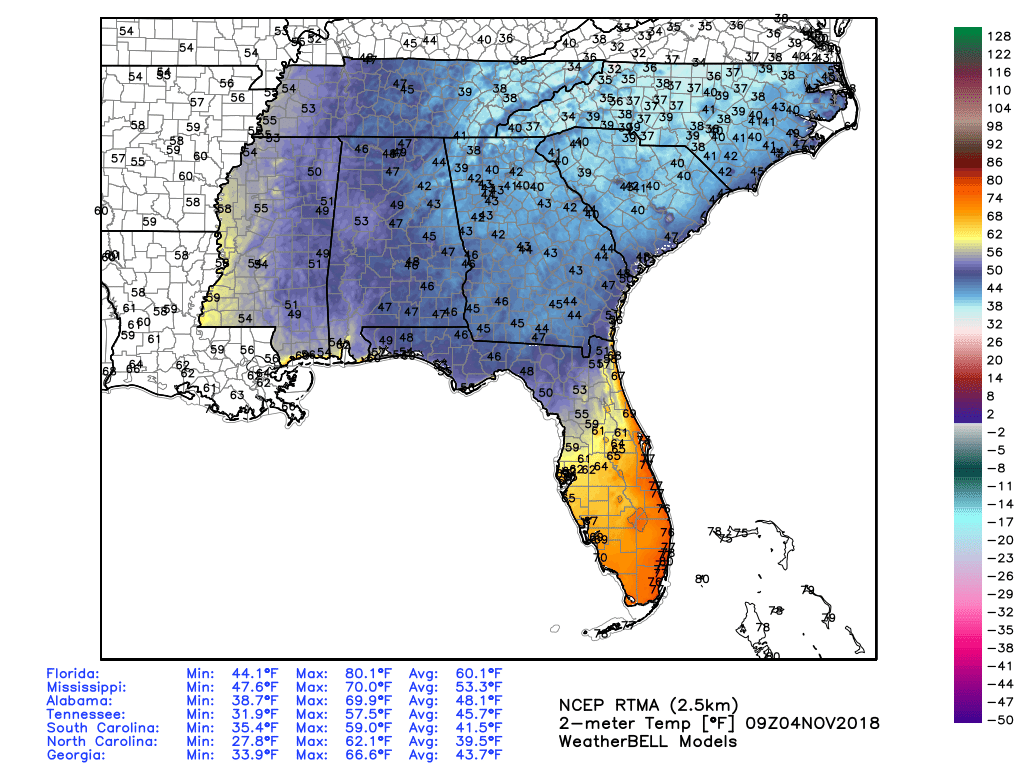
5 am Southeast Temperatures
TODAY'S FORECAST
TEMPERATURES
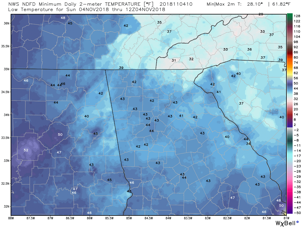
Low Temps This Morning
|
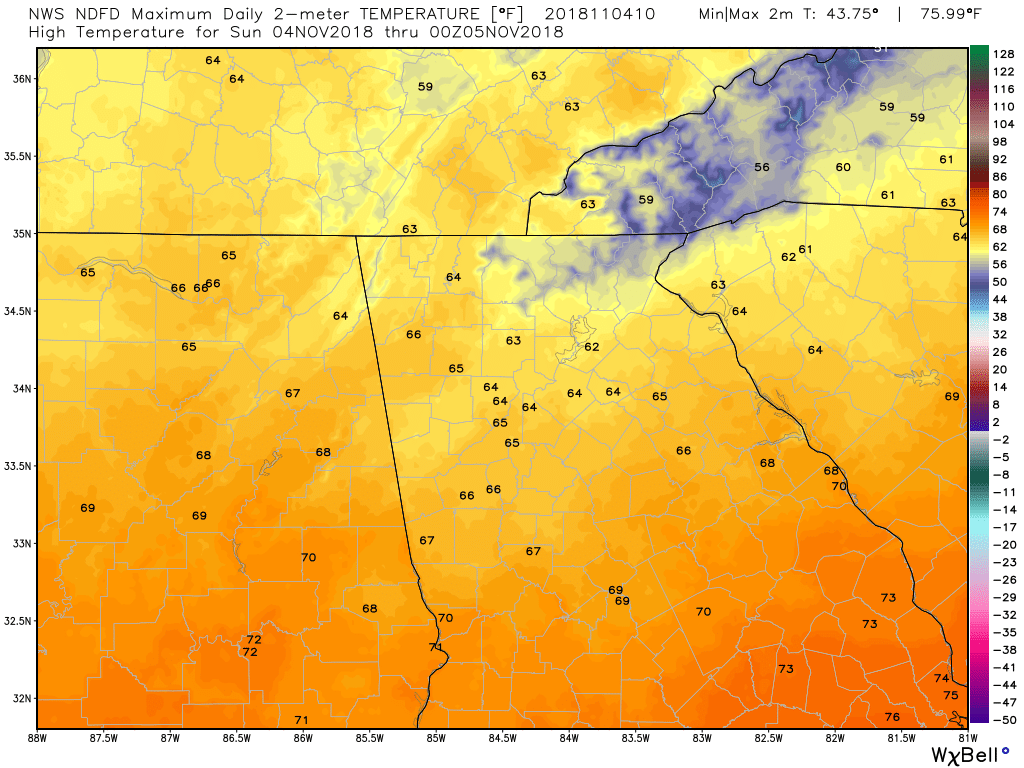
High Temps Today
|
TEMPERATURE ANOMALIES
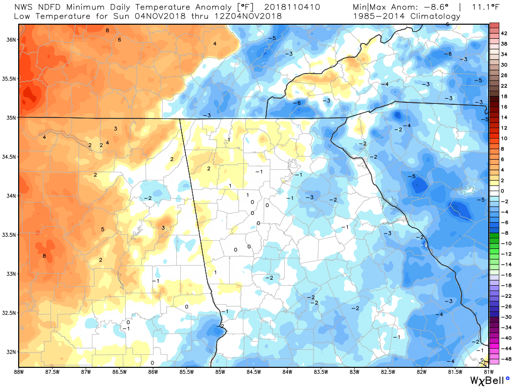
Low Temp Anomalies This Morning
|
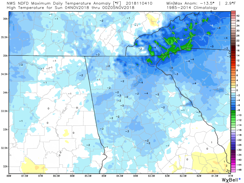
High Temp Anomalies Today
|
WIND
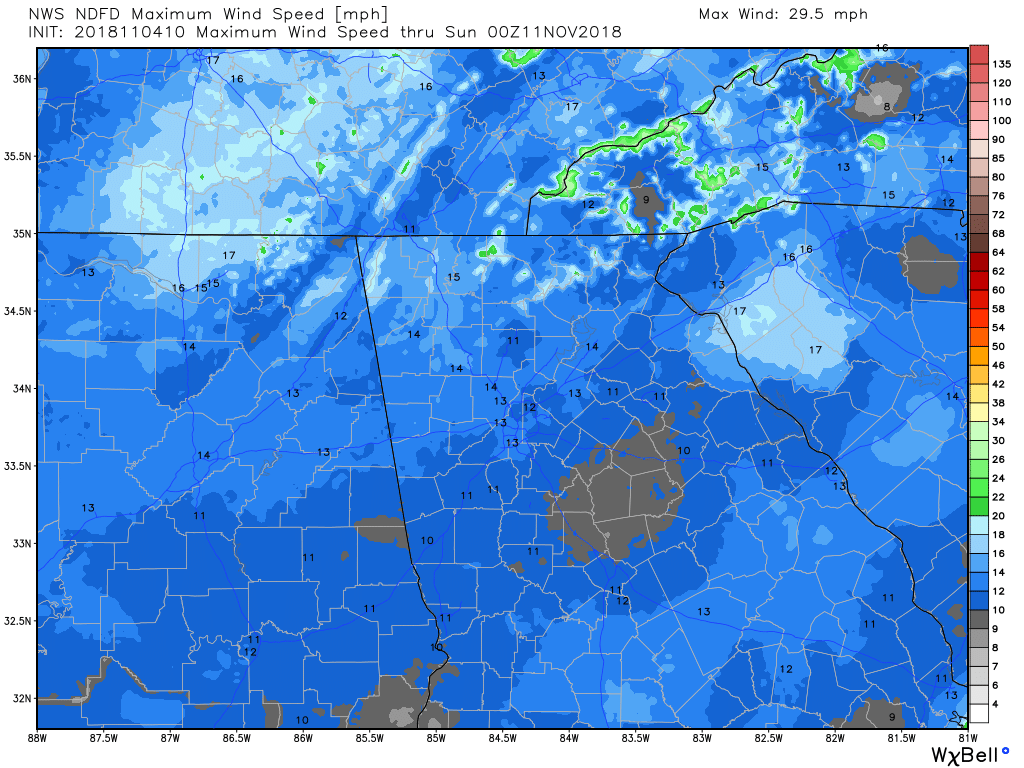
Max Wind Speed
|
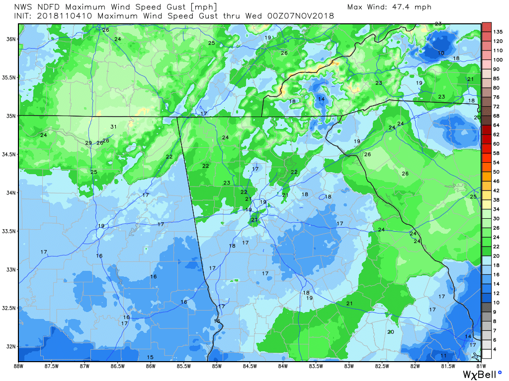
Max Wind Gust
|
PRECIPITATION
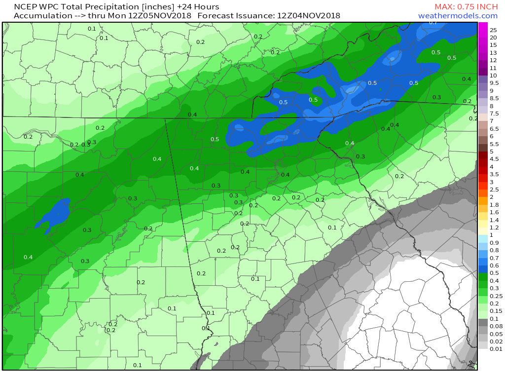
WPC - 24 Hour Precipitation Forecast
|
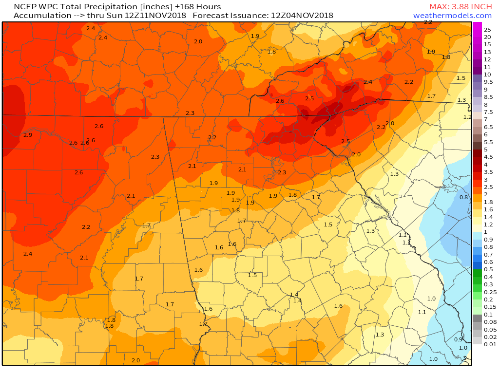
WPC - 7 Day Precipitation Forecast
|
0 Comments
Recommended Comments
There are no comments to display.