
Weather on This Date - January 11

Entry posted by NorthGeorgiaWX
628 views
January 11, 1918
A tremendous blizzard completely immobilized the Midwest, stopping mail service for two weeks. The vast storm then moved through the Great Lakes Region and the Ohio Valley. Winds reached 60 mph at Toledo OH, and the temperature plunged from 28 above to 15 below zero during passage of the cold front. (David Ludlum)
January 11, 1972
Downslope winds hit the eastern slopes of the Rockies in northern Colorado and southeastern Wyoming. Boulder CO reported wind gusts to 143 mph and twenty-five million dollars property damage. (David Ludlum)
January 11, 1987
A storm in the northeastern U.S. buried the mountains of central Vermont with up to 26 inches of snow, and snowfall totals in Maine ranged up to 27 inches at Telos Lake. Winds gusted to 45 mph at Newark NJ and Albany NY. (National Weather Summary) (Storm Data)
January 11, 1988
Snow and high winds in Utah resulted in a fifty car pile-up along Interstate 15. Winds in Wyoming gusted to 115 mph at Rendezvous Peak. (National Weather Summary) (Storm Data)
January 11, 1989
A cold front which the previous day produced 21 inches of snow at Stampede Pass WA and wind gusts to 75 mph at Mammoth Lakes CA, spread snow across Colorado. Totals in Colorado ranged up to 17 inches at Steamboat Springs. (National Weather Summary) (Storm Data)
January 11, 1990
Strong northwesterly winds associated with a deep low pressure system crossing the Upper Great Lakes Region ushered cold air into the central U.S. Winds gusted to 72 mph at Fort Dodge IA, and wind gusts reached 75 mph at Yankton SD. Snow and high winds created blizzard conditions in northwestern Minnesota. Squalls produced heavy snow in parts of Upper Michigan and northern Lower Michigan, with 16 inches reported at Wakefield. (National Weather Summary) (Storm Data)
January 11, 2008
Iraqis in Baghdad woke up to the novelty of falling snowflakes as the city experienced its first snowfall in about 100 years. (NCDC)
January 11, 2014
Only a few days after an arctic blast brought the coldest temperatures in nearly 40 years, a strong storm system developed over the middle of the country and moved into north and central Georgia spawning a squall line that brought severe thunderstorms to north Georgia. One tornado, an EF-0, was on the ground for 3 miles near Waleska in Cherokee County. This tornado downed trees and damaged a fence. In Cedartown (Polk County), straight line winds of 80 mph struck the Floyd Polk Medical Center causing damage to the building. Fortunately no injuries occurred in either event. For more information, visit the event summary. (NWS Atlanta)
Data courtesy of WeatherForYou

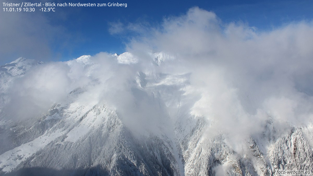
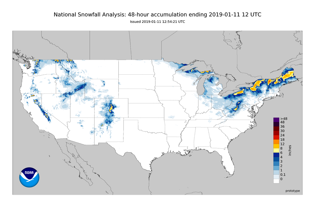
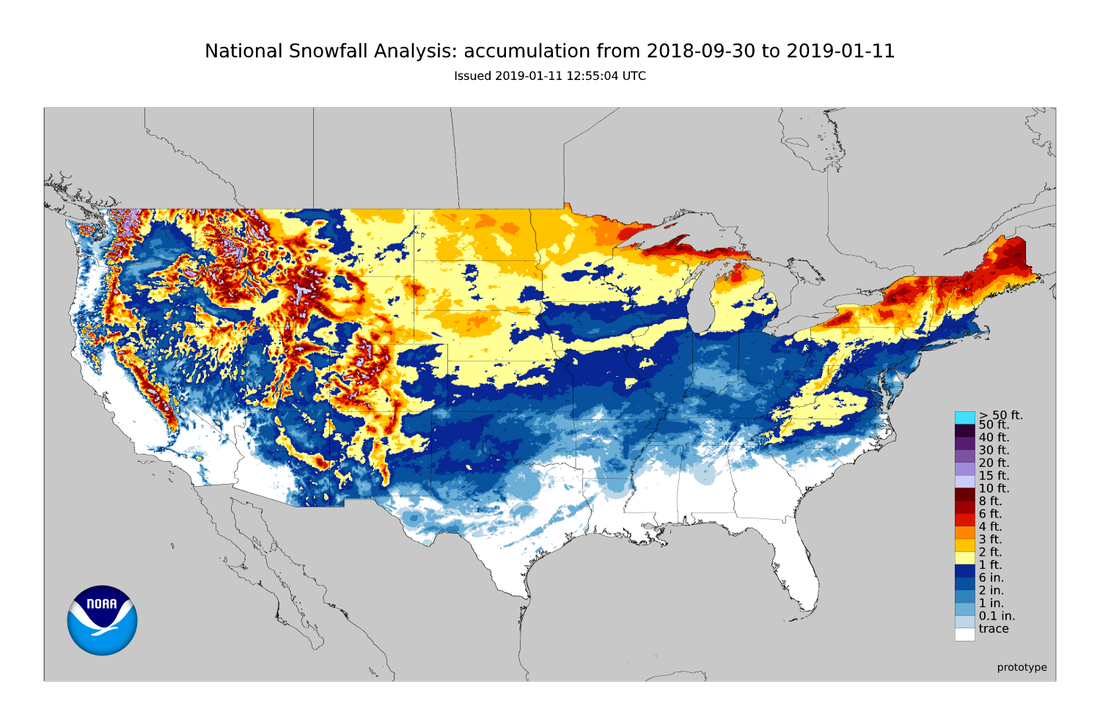
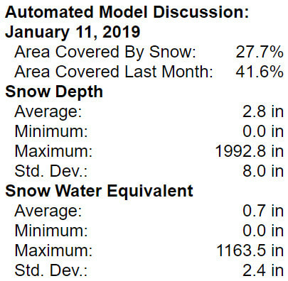
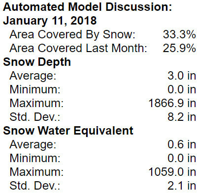
Snow Cover Analysis
|
|
0 Comments
Recommended Comments
There are no comments to display.