
2019 Tire Rack Lincoln Spring Nationals Champ Tour Weather

Entry posted by NorthGeorgiaWX
352 views

Welcome back to Lincoln and welcome back to the Lincoln weather!
Without wasting any of your time (I hope), let's get to an overview of what may be in store for the event this weekend.
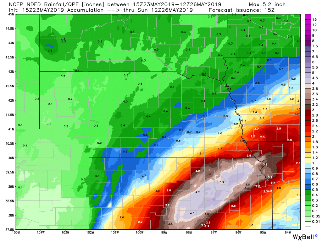
The last thing that you want to hear when you're on that wide open concrete cornfield is that there is severe weather around, because there is absolutely no place to go. With that being said... there is a chance for severe weather for at least three of the days you'll be there. Keep in mind, these Risk areas are subject to change right now, and I think the area on Monday may be the one to really watch for. Either way, rain is in the forecast. No, it won't be rain like the rain that occurred at the Nationals last year, but rain like that isn't too far away, so we need to watch for any shifts in the central axis of rainfall. The 72 hour rainfall map is at the bottom of the post.
I'll be back with more updates, and I'll be watching the potential severe weather for you. With boring weather here in Atlanta, it will be a nice change. 🙂
Without wasting any of your time (I hope), let's get to an overview of what may be in store for the event this weekend.
The last thing that you want to hear when you're on that wide open concrete cornfield is that there is severe weather around, because there is absolutely no place to go. With that being said... there is a chance for severe weather for at least three of the days you'll be there. Keep in mind, these Risk areas are subject to change right now, and I think the area on Monday may be the one to really watch for. Either way, rain is in the forecast. No, it won't be rain like the rain that occurred at the Nationals last year, but rain like that isn't too far away, so we need to watch for any shifts in the central axis of rainfall. The 72 hour rainfall map is at the bottom of the post.
I'll be back with more updates, and I'll be watching the potential severe weather for you. With boring weather here in Atlanta, it will be a nice change. 🙂
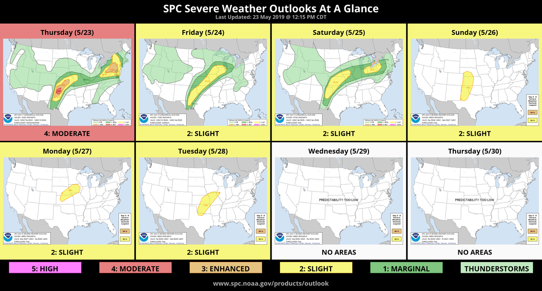
Here are the thoughts from the Omaha NWS office right now:
There could be lingering showers in the morning for eastern areas, but renewed shower/thunderstorm development is expected south of I80 Friday afternoon through Friday night, with rain chances across the entire area Saturday as another weak front settles southward into the region. It`s at that point that we`ll have to monitor for day-to-day rainfall south of I-80, and may eventually become concerned with saturated soils. Heaviest rains appear to continue to set up across KS/MO just south, but a few counties in southwest IA and extreme southeast NE could be at risk for flooding as well. Highs both Friday and Saturday in the upper 70's to lower 80's, above normal.
And these are the thoughts from the Storm Prediction Center
Friday
Richer low-level moisture with mid-upper 60's F dewpoints will advect northeast through the mid-upper MS Valley warm sector during the day, and this should contribute to a corridor of moderate instability (1500-2000 J/kg MLCAPE) as the boundary layer warms.
Some storms may be ongoing on cool side of the warm front as well as farther west across KS in vicinity of the cold front. The cold frontal storms should diminish early in the day, but additional storms will probably develop along the cold front or residual outflow boundaries as the atmosphere destabilizes during the afternoon. Flow in the lowest 3 km is forecast to weaken and the strongest mid-upper winds will likely remain north of the warm sector which could be limiting factors for a more robust severe threat. Nevertheless, winds aloft will be sufficient for 45-55 kt largely unidirectional effective bulk shear.
Where boundary layer destabilization occurs, the parameter space should promote some risk for strong to severe storms with large hail and damaging wind the main threats. A conditional risk for tornadoes will exist especially if boundary layer recovery can occur in IA and northern IL where low-level hodographs will be more supportive along and just south of the warm front.
Saturday
Current indications are that a surface front will stall from southern WI southwest into southeast NE and western KS with a dryline extending farther south through west TX. Rich low-level moisture with dewpoints in the mid-upper 60's F will reside south and east of these boundaries contributing to potential for moderate to strong instability. Weak impulses embedded within a broad fetch of moderate southwest winds aloft combined with dryline and frontal convergence will contribute to potential for thunderstorm initiation as the boundary layer destabilizes during the afternoon.
Vertical wind profiles will be sufficient for organized storms including supercells, but activity may eventually grow upscale as it progresses east during the overnight. Large hail, damaging wind and a few tornadoes will be possible.
Monday
Day 5 (Monday) Thunderstorms associated with the lead impulse will continue through the upper MS Valley region early. Destabilization is expected upstream, and storms may redevelop along a southward-advancing cold front across the central Plains and possibly some distance southward along the dryline. Have introduced a risk area for the area of most likely redevelopment from near the triple point across western KS, northeast along the sharpening cold front.
Temperatures
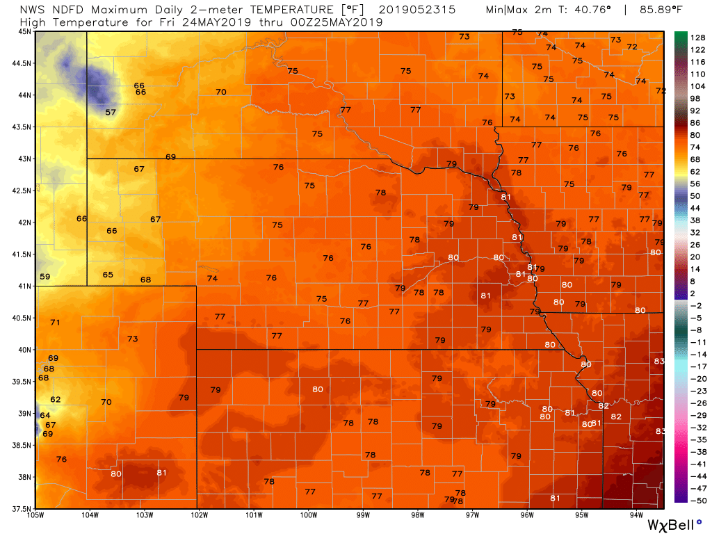
Friday
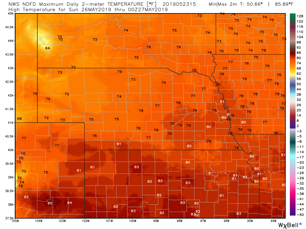
Sunday
|
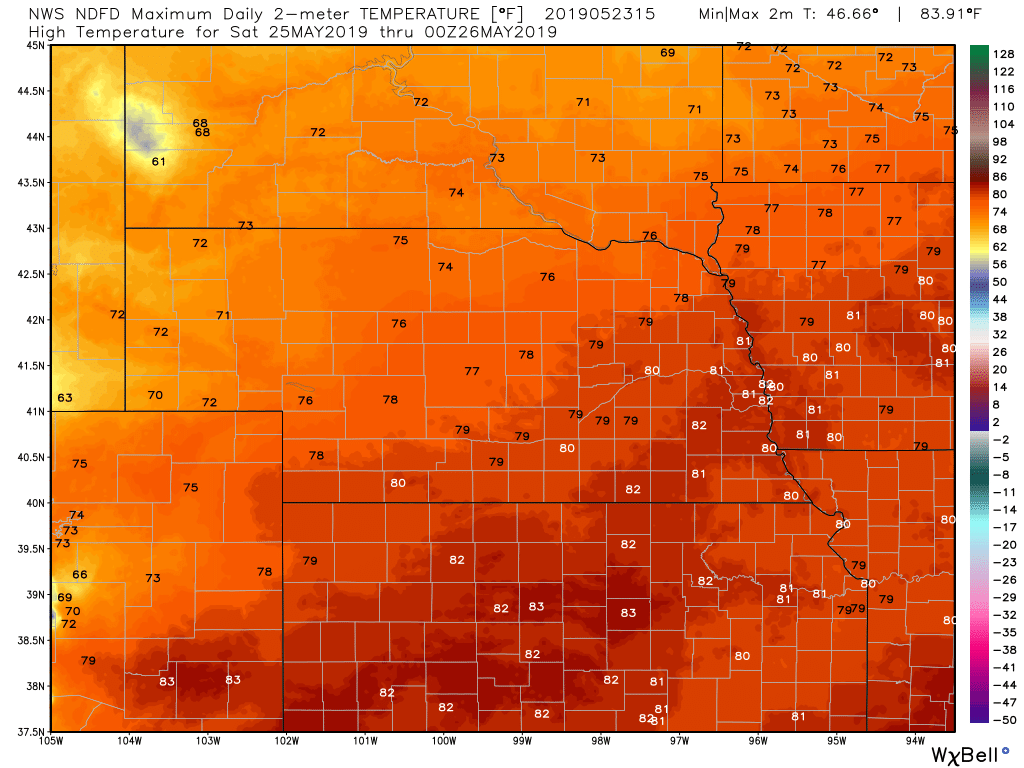
Saturday
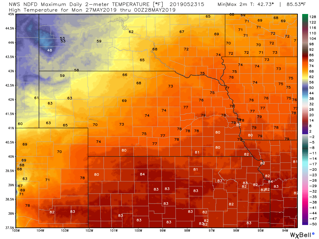
Monday
|
Precipitation through 8 am Sunday
0 Comments
Recommended Comments
There are no comments to display.