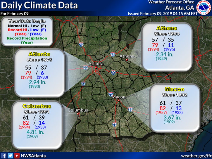
Weather on This Date - February 9
February 9, 1933
The temperature at Moran, WY, located next to Tetons National Park, plunged to 63 degrees below zero to establish a state record. The temperature at the Riverside Ranger Station in Montana dipped to 66 below zero to establish a record for the state, and a record for the nation which stood until 1954. (David Ludlum)
February 9, 1934
The mercury dipped to 51 degrees below zero at Vanderbilt to establish a record for the state of Michigan. The temperature at Stillwater plunged to 52 degrees below zero to establish a record for the state of New York. (David Ludlum)
February 9, 1987
A storm off the Atlantic coast produced high winds and heavy snow in the northeastern U.S., with blizzard conditions in eastern Massachusetts. Wind gusted to 80 mph and 23.4 inches of snow produced drifts eight feet high at Cape Cod MA. It was the worst blizzard in thirty years for the Cape Cod area. Winds in some of the mountains and ridges of the Appalachian Region gusted to 100 mph. (The National Weather Summary) (Storm Data)
February 9, 1988
Arctic cold invaded the north central U.S. Alliance NE plunged from 44 degrees to 12 above in just two hours, and Mobridge SD reported a wind chill of 64 degrees below zero. Winds along the eastern slopes of the Rockies gusted to 90 mph at Cheyenne WY, and reached 96 mph at Boulder CO. (The National Weather Summary) (Storm Data)
February 9, 1989
A winter storm continued to bring rain and snow to southern California. Snowfall totals ranged up to 18 inches at Olancha, with three inches at Palmdale. (The National Weather Summary) (Storm Data)
February 9, 1990
Thunderstorms developing ahead of a cold front erupted over eastern Texas late in the morning, and produced severe weather as they swept across the southeastern states. Early evening thunderstorms spawned a tornado which injured one person at Nat TX, and produced tennis balls size hail which caused more than half a million dollars damage around Shreveport LA. (The National Weather Summary) (Storm Data)
February 9, 2011
Very cold temperatures aloft associated with a short wave embedded within an upper trough, helped to bring a band of moderate snow across much of north and the northern parts of central Georgia during the evening of the 9th and into the early morning hours of the 10th. Snowfall averaged from 1 to 2 inches across most north Georgia counties, with 0.5 to 1 inch across the northern portions of central Georgia. (NWS Atlanta)
Data courtesy of WeatherForYou


0 Comments
Recommended Comments
There are no comments to display.