 Temp Anomalies for Sunday
Well, at least I have a few alternatives for posting information. Starting today I will be making these consolidated "daily" post. They will contain everything that I would normally share in a day, all rolled up into one post. Who knows, it may be easier for you to read instead of wading through multiple post. But this will mean that you will have to come back here to get the updates. I can post a comment on FB when I do an update, but that's about it.
This consolidated post will be ordered with the most recent update at the bottom and I will time stamp each update for you. All I ask is that if you like the post, to please click on the Facebook button at the bottom to "Like" it. Since the Facebook page isn't working, new followers will be harder to come by, so those likes will go a long way in helping me out.
Thursday, 8:33 am
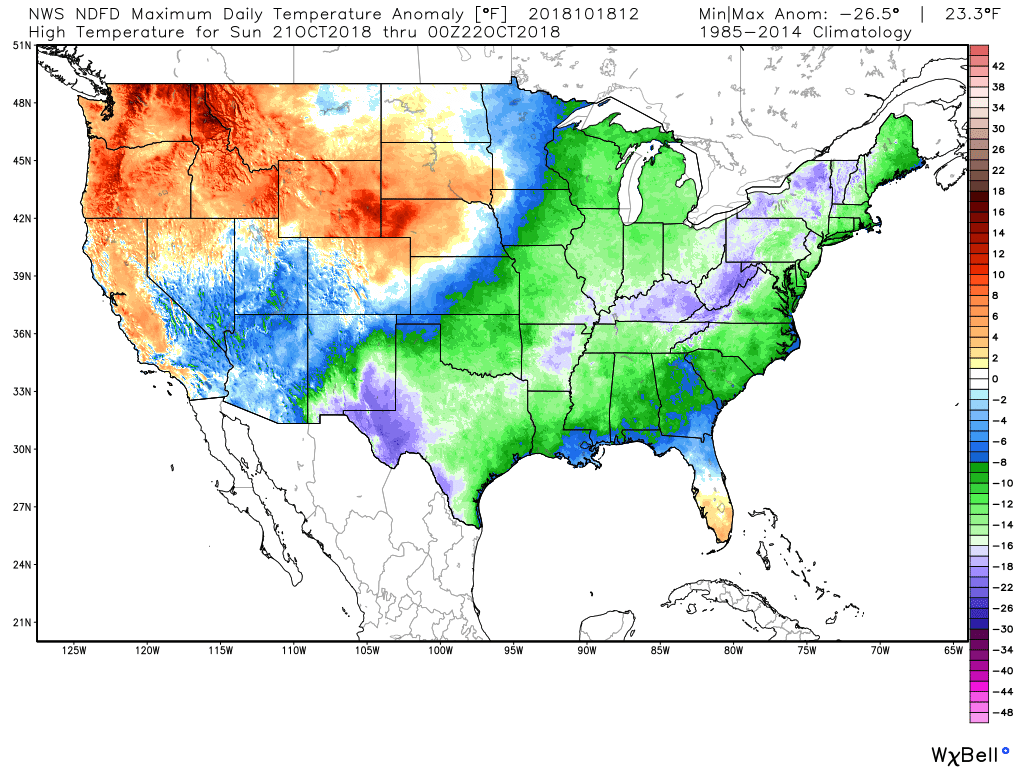
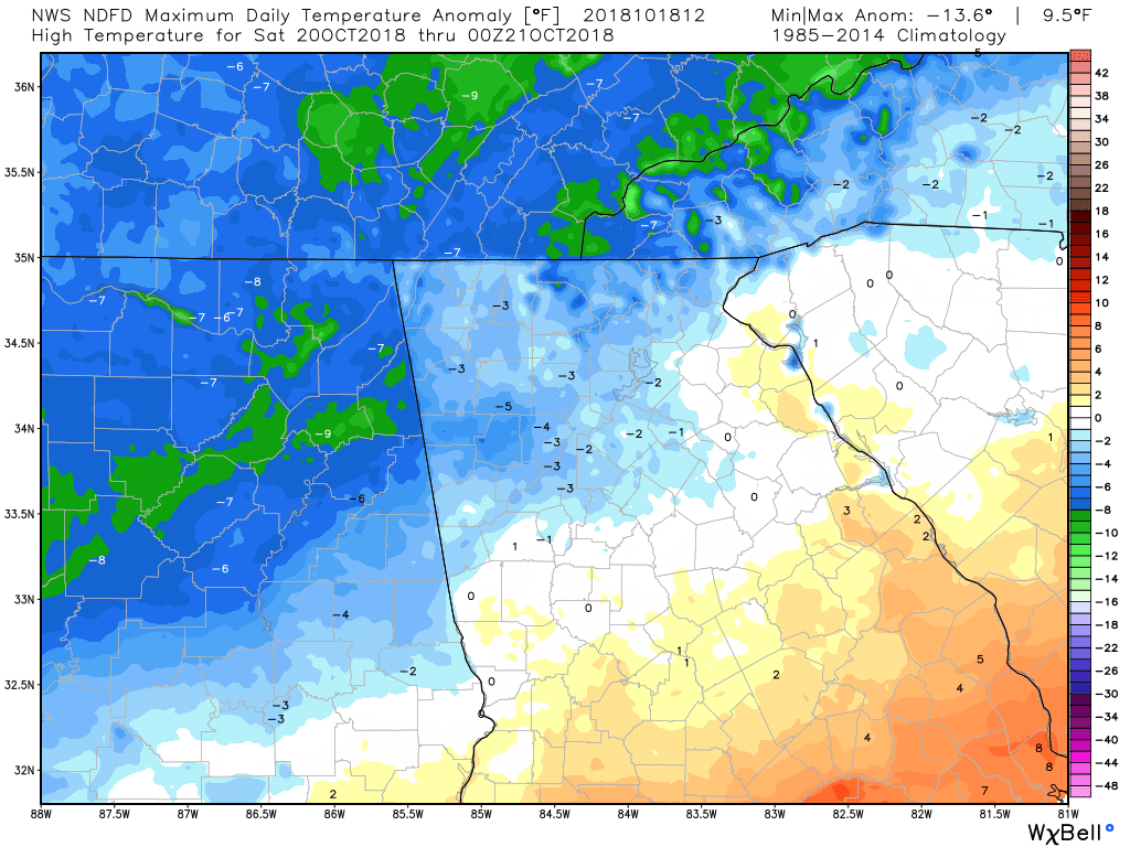
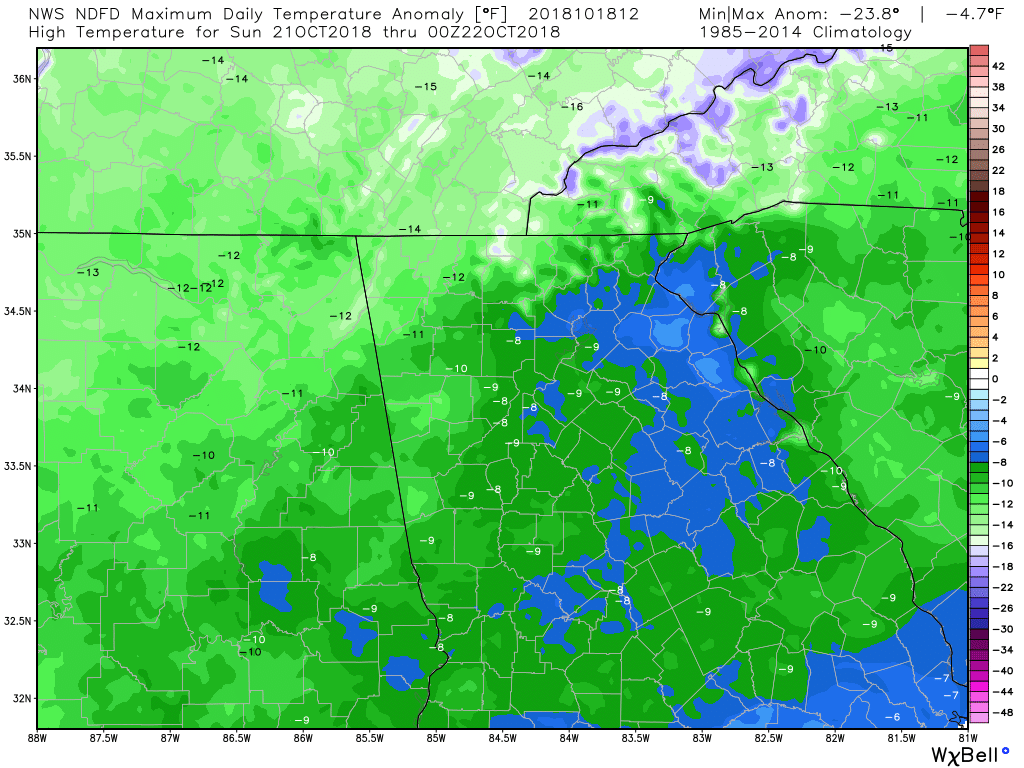
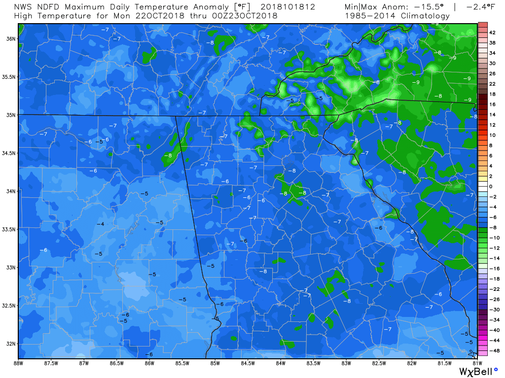
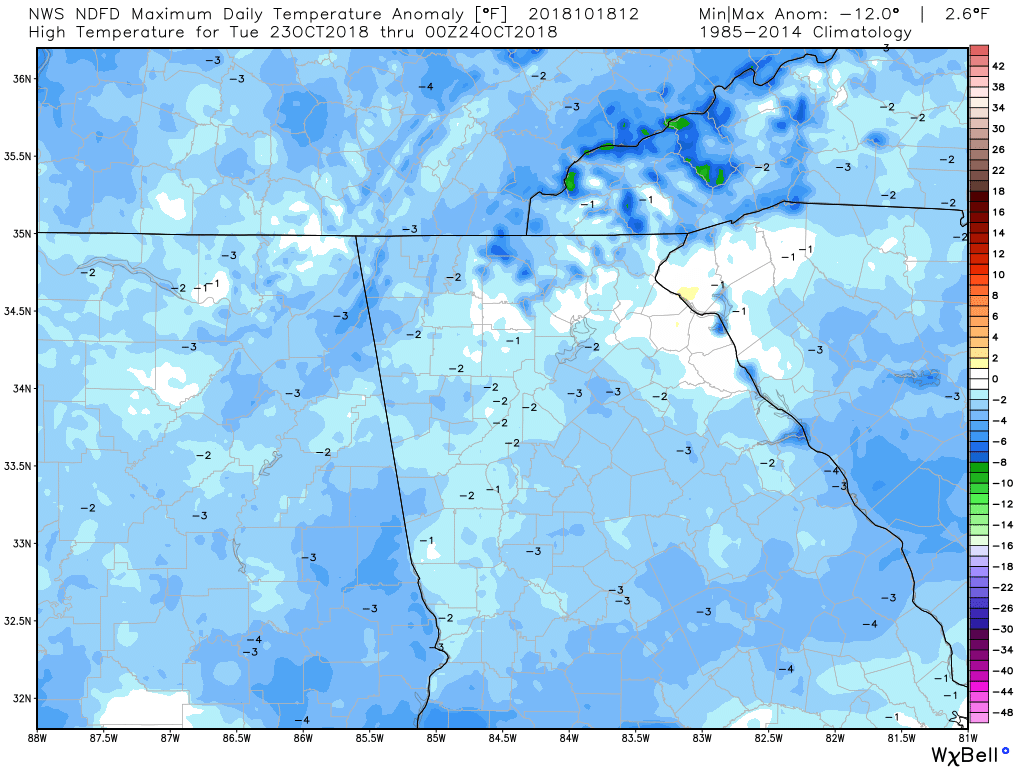
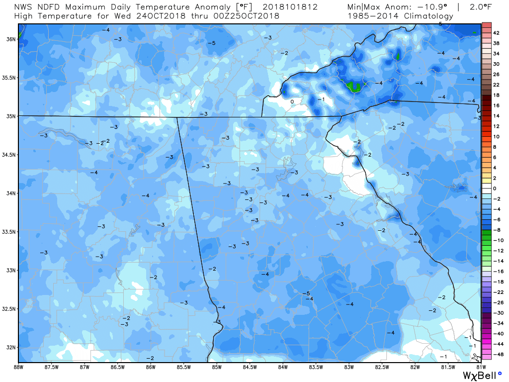
If it doesn't feel like fall for you yet, it will very soon. It's looking like our high temps will be below normal for about a week. With rain coming in on Saturday, we'll see a little bump up, but still below normal. The six images below are the high temperature anomalies through Wednesday, and as you can see, we will finally get a week of BELOW normal temps instead of above.
Thursday, 9:05 am
Blocking events are what helps to push the cold air south. And speaking of cold air, the very NW corner on NC and NE corner of TN could see a flake or two of snow. Fun times ahead! :-)
A striking amount of high-latitude Northern Hemisphere blocking is forecast over the next 4 weeks □
Persistent upper troughs in the vicinity of the Bering Sea and central-eastern U.S. [JMA weeklies] pic.twitter.com/YFU1hTmEOv — Ben Noll (@BenNollWeather) October 18, 2018
|
Saturdays cold front brings the 1st chance of snow in the mountains for the season. A short-lived northwest flow snow is likely Saturday night into early Sunday. Accumulations not likely or very light but snow showers are likely in the favored areas. #wncwx #snOMG pic.twitter.com/4j0YZeTlE3 — Brad Panovich (@wxbrad) October 18, 2018
|
Thursday, 10:12 am
Thursday, 11:26 am
The evolution of a potentially significant storm system across the eastern US is now within the ECMWF Op long-range prognostication. Note the negatively tilted, digging trough and the vort max over the central Plains in the 10-12 day range. Maps: @RyanMaue | @weathermodels_ pic.twitter.com/xrdYRnLdnP — John Kassell (@JPKassell) October 18, 2018
|
|
Thursday, 12:13 pm
Animated GIF showing the 10 day temperature anomalies from the 00Z Euro operational run.
Thursday, 1:43 pm
Here's the Weekly Weather Briefing from the Atlanta NWS office.
Thursday, 2:48 pm
Whoa!!!
View the full article


 Temp Anomalies for Sunday
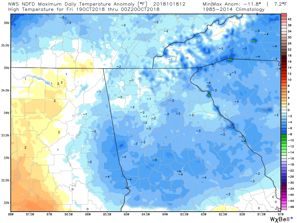
0 Comments
Recommended Comments
There are no comments to display.