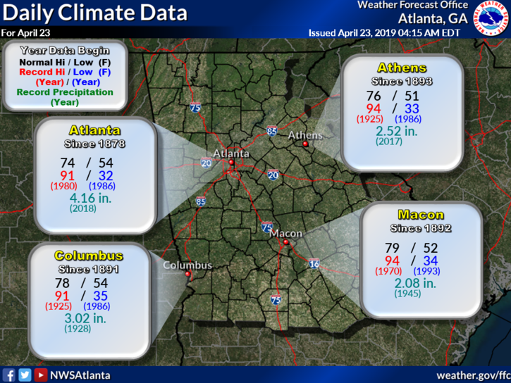
Weather on This Date - April 23
Today in Weather History
for April 23
April 23, 1885
The city of Denver, CO, was in the midst of a storm which produced 23 inches of snow in 24 hours, and at Idaho Springs CO produced 32 inches of snow. (David Ludlum)
April 23, 1910
The temperature at the Civic Center in Los Angeles, CA, hit 100 degrees to establish an April record for the city. (The Weather Channel)
April 23, 1983
A mini-blizzard produced sixteen inches of snow at Laramie, WY, including a foot of snow in just eight hours during the night. (The Weather Channel)
April 23, 1987
Thunderstorms in the Atlantic Coast Region produced golf ball size hail and wind gusts to 67 mph at Anderson SC. The high winds destroyed two planes at the airport, and the large hail damaged fifty other planes, and severely damaged twenty-three greenhouses. (The National Weather Summary) (Storm Data)
April 23, 1988
An intense winter-like storm brought thunderstorms to southern California, and produced snow in some of the higher elevations. Nine girls at Tustin CA were injured when lightning struck the tree under which their softball team had taken shelter from the rain. (The National Weather Summary) (Storm Data)
April 23, 1989
Salina, KS, was the hot spot in the nation with a high of 105 degrees. The high of 105 degrees established an April record for the state of Kansas. A total of eighteen cities in the central U.S. reported record high temperatures for the date. (The National Weather Summary) (Storm Data) (The Weather Channel)
April 23, 1990
Thunderstorms produced severe weather in West Texas and western Oklahoma. Thunderstorms produced tennis ball size hail at Lake McKenzie TX and at Garden City TX, and produced wind gusts to 90 mph at Gage OK. Thunderstorms drenched southeast Minnesota with heavy rain, with 6.6 inches reported northwest of Browndale. High temperatures were mostly in the 80s across the central U.S. The morning low of 67 degrees at Fargo ND and afternoon high of 91 degrees were both records for the date. (Storm Data) (The National Weather Summary)
April 23, 2009
A strong shortwave, embedded within northwest flow aloft, combined with a very unstable surface air mass to result in the development of numerous, large-hail producing severe thunderstorms. Many reports of quarter to golf ball sized hail were received across primarily the northern half of the state. (NWS Atlanta)
Data courtesy of WeatherForYou


0 Comments
Recommended Comments
There are no comments to display.