2019 Tire Rack Lincoln Spring Nationals Champ Tour Weather - Friday
This blog is sucking the content from my old blog via a RSS feed, and it doesn't always get the formatting correct, so I may do some of the blog post directly from this site. Anyway... this was from this is morning... sort of. 😛
Good Friday morning to everyone!
We have some active weather on Lincoln's doorstep for this afternoon and evening, and I know some strong storms came through last night. If you travel with your car in a trailer, that's great. There will be a chance for some large hail and high winds, and at least in the trailer your car is relatively safe. Also, please make sure you securely tie down everything in the paddock so nothing becomes a lethal weapon in high winds.
So we need to jump right in to the Omaha NWS Discussion and follow with the thoughts of the Storm Prediction Center.
NWS Omaha Area Forecast Discussion
However, precipitation chances will increase once
again across southeast Nebraska and southern Iowa Friday afternoon
and evening as convection develops along the cold front trailing
behind the aforementioned departing low. There`s a marginal risk
for large hail and damaging winds across southeast
Nebraska/southwest Iowa Friday afternoon and evening. And, while
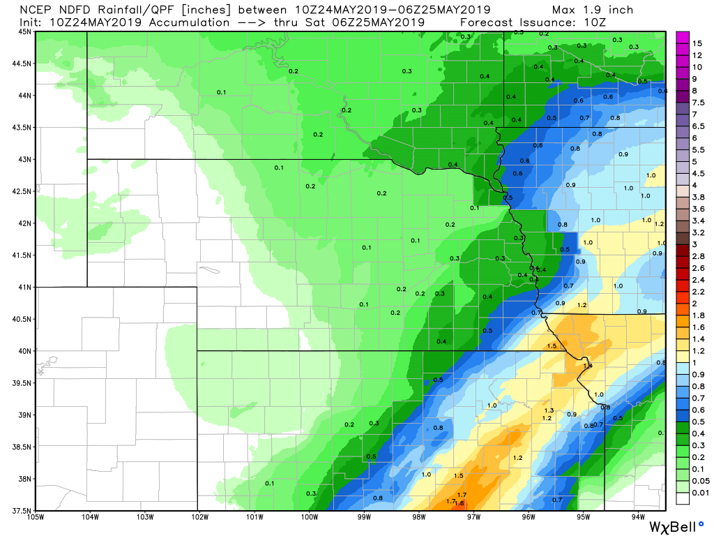
heaviest rain is expected to remain just to our southeast in
Kansas and Missouri, there is still the potential for an inch or
more of heavy rain across extreme southeast Nebraska and southwest
Iowa. Therefore, we included this area in a Flash Flood Watch for
this morning through early Saturday morning.
Another developing surface low will pass through eastern Nebraska
Saturday afternoon, draping another frontal boundary across the
southeastern half of the CWA. Steep lapse rates, abundant low
level moisture, and moderate deep shear and instability will lead
to yet another severe weather risk over the area. Large hail and
damaging winds will be the primary threats once again.
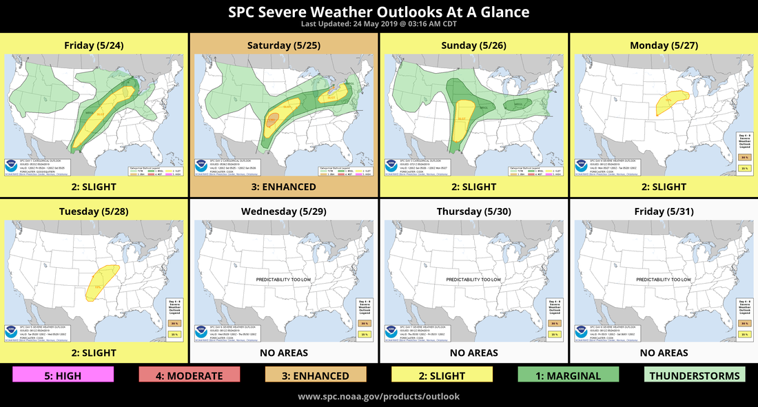
More on the severe potential from the SPC
SPC Day 1 Outlook
SPC Day 1 Outlook
Beneath the belt of fast southwesterly flow, a weak baroclinic zone is forecast to extend south-southwestward across the Plains, while a weak warm front lifts slowly northward across the Midwest. The specific location of the aforementioned Plains front remains uncertain -- largely due to outflow associated with ongoing convection expected to linger into the beginning of the period. As this outflow/frontal conglomerate will play a substantial role in subsequent diurnal convection, narrowing down possible areas of more concentrated risk stemming from afternoon storms.
With that said, the overall environment will feature a moist/destabilizing warm-sector airmass, and with the belt of enhanced flow aloft collocated with the favorable thermodynamics, strong/locally severe storms will result. While flow across the Plains will exhibit at least some west-of-south orientation across much of the area, little veering with height is expected, which should limit tornado potential across much of the region, with large hail and locally damaging winds the main risks. Exceptions would be near any possible remnant convective circulations, and also over the upper Midwest region (parts of the Iowa/southern Wisconsin/northern Illinois vicinity) near the weak warm front. Resulting, more favorable low-level directional shear suggests slightly greater risk for a couple of tornadoes across these areas. After reaching a diurnal peak, a slow decrease in convective coverage and intensity is expected into the evening. Storms may maintain intensity longer over the upper Midwest/southern Upper Great Lakes area, where a 50-plus kt southwesterly low-level jet is expected to evolve.
So keep on a lookout this afternoon and evening for some strong storms to develop. Hope everyone stays safe and goes fast! 🙂
Have an awesome day!
Have an awesome day!


0 Comments
Recommended Comments
There are no comments to display.