
Weather on This Date - November 7

Entry posted by NorthGeorgiaWX
560 views

November 7, 1940
The Galloping Gertie bridge at Tacoma, WA, collapsed in strong winds resulting in a six million dollar loss, just four months after the grand opening of the new bridge. The winds caused the evenly sized spans of the bridge to begin to vibrate until the central one finally collapsed. From that point on bridges were constructed with spans of varying size. (David Ludlum)
November 7, 1951
At 7 AM a blinding flash, a huge ball of fire, and a terrific roar occurred over parts of Texas, Oklahoma and Kansas, caused by a disintegrating meteor. Windows were broken in and near Hinton OK by the concussion. (The Weather Channel)
November 7, 1966
A severe thunderstorm produced an F-1 tornado which traveled for 6 miles across Lumpkin, Hall, and White Counties. Along its path it caused $400,000 in damage, part of that occurring at Camp Hope, a youth camp at the Hall/Lumpkin county line, which suffered mass destruction. This tornado also injured 12 people along its 6 mile path. (NWS Atlanta)
November 7, 1986
An early season blizzard struck the Northern Plains Region. North Dakota took the brunt of the storm with wind gusts to 70 mph, and snowfall totals ranged up to 25 inches at Devils Lake. (Storm Data)
November 7, 1987
Heavy snow fell across parts of eastern New York State overnight, with twelve inches reported at the town of Piseco, located in the Mohawk Valley. A storm in the southwestern U.S. left nine inches of snow at the Winter Park ski resort in Colorado. Smoke from forest fires reduced visibilities to less than a mile at some locations from North Carolina to Ohio and Pennsylvania. (The National Weather Summary) (Storm Data)
November 7, 1988
Unseasonably warm weather continued across the state of Texas. Seven cities reported record high temperatures for the date, including Waco and Del Rio with readings of 92 degrees. McAllen was the hot spot in the nation with a high of 96 degrees. (The National Weather Summary)
November 7, 1989
Shortly after daybreak strong thunderstorms developed over a narrow, but almost stationary, east-west band across New Orleans, in southeastern Louisiana. As a result, heavy rains persisted over the same area until mid afternoon before tapering off, and triggered flash flooding across a five county area. Eight to twelve inch rains deluged the area between 9 AM and 6 PM, and totals for the 48 hour period ending at 7 AM on the 8th ranged up to 19.78 inches, between Lake Lexy and Lake Borgne. Approximately 6000 homes in the area reported water damage. The rainfall total for November of 19.81 inches at New Orleans was their highest total for any given month of the year. (The National Weather Summary) (Storm Data)
Data courtesy of WeatherForYou
TODAY'S WEATHER SUMMARY
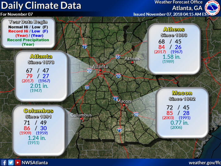
Today's Climate Records and Averages
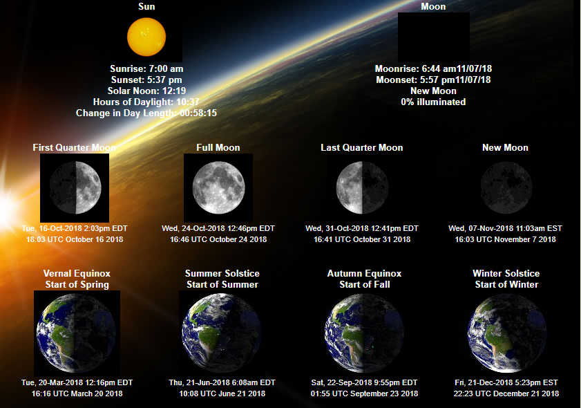
Astronomical Information for Today - Accurate for Gwinnett County GA
5:00 AM TEMPS, DEW POINTS, and WIND CHILL
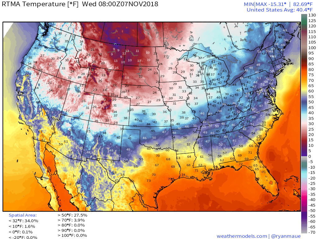
Temperatures
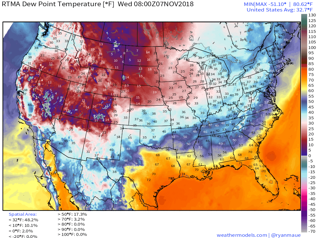
Dew Points
|
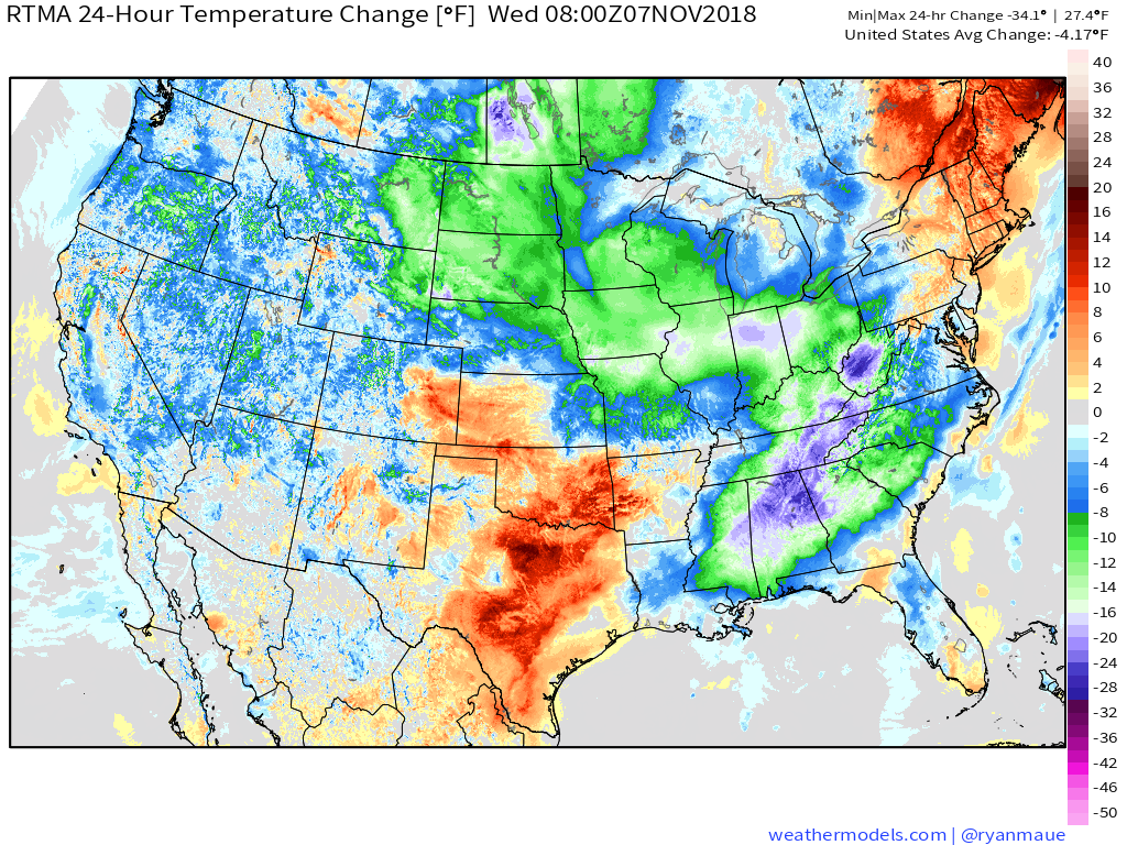
24 Hour Temp Change
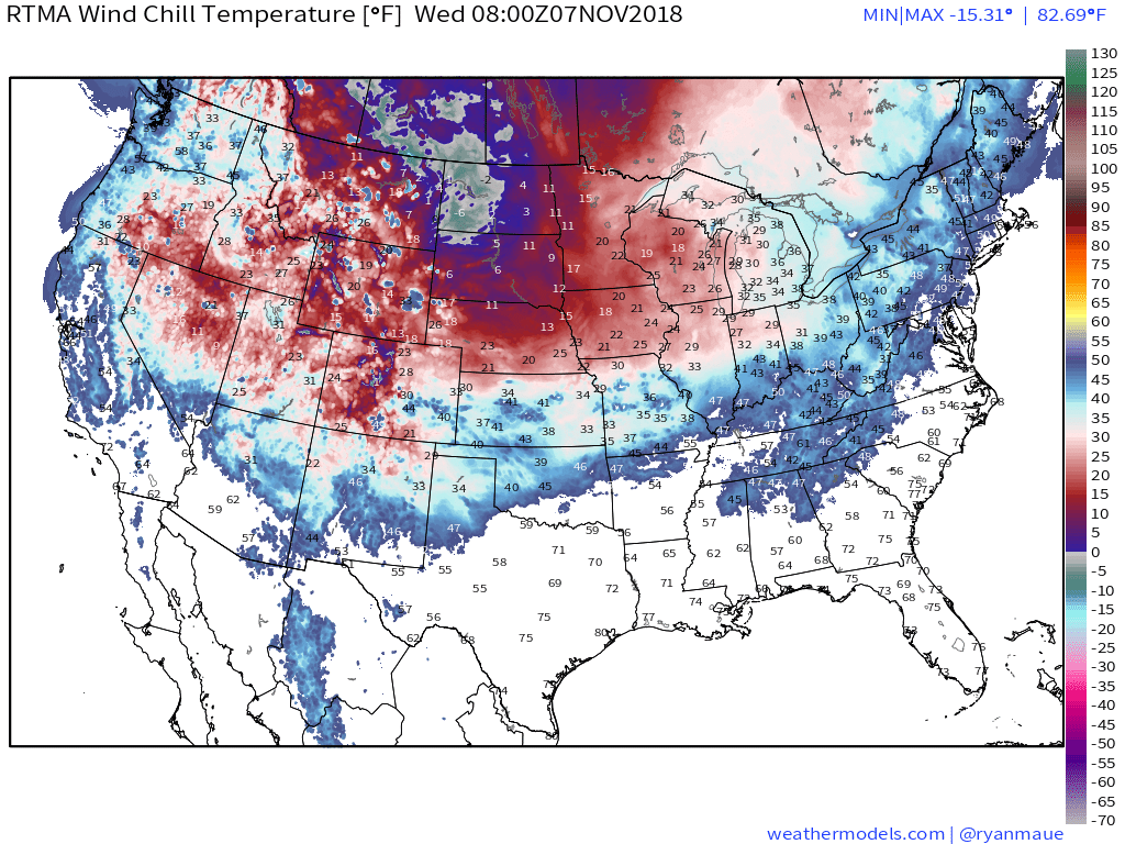
Wind Chill
|
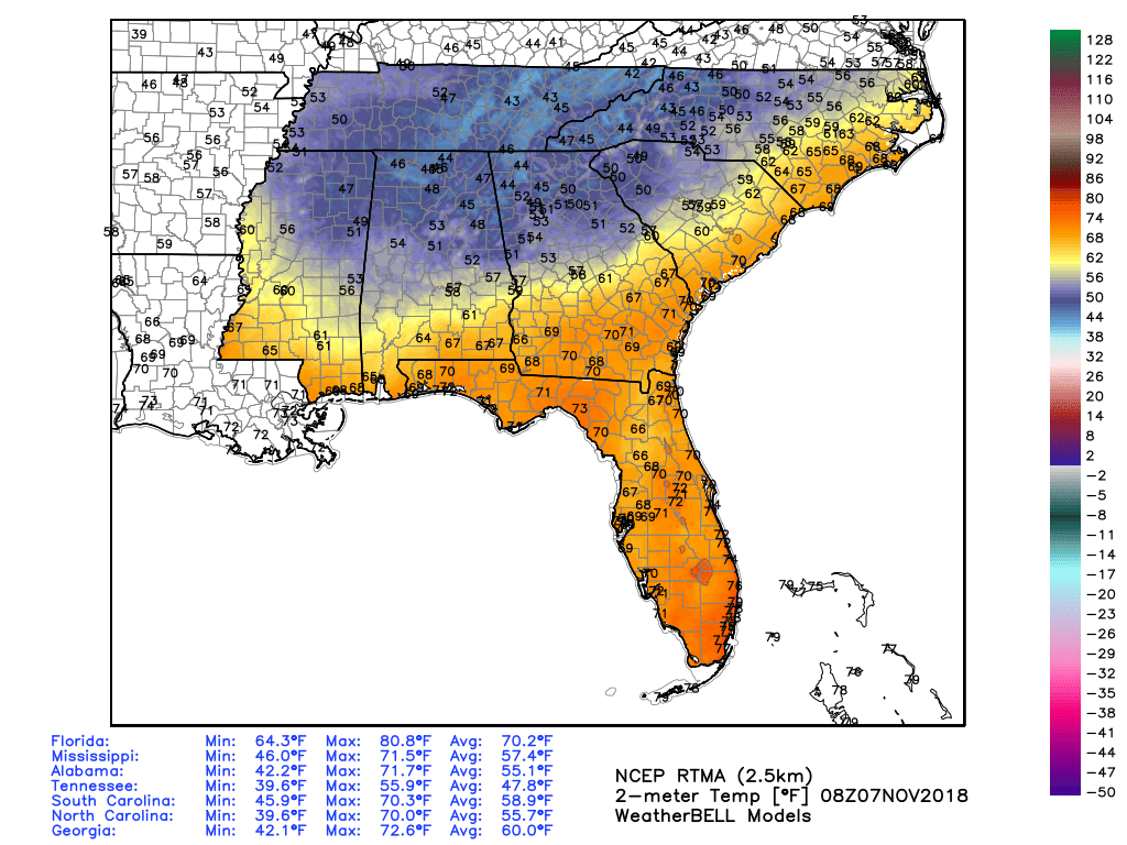
5 am Southeast Temperatures
TODAY'S FORECAST
TEMPERATURES
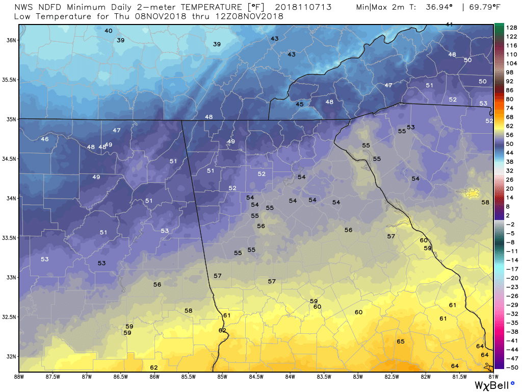
Low Temps This Morning
|
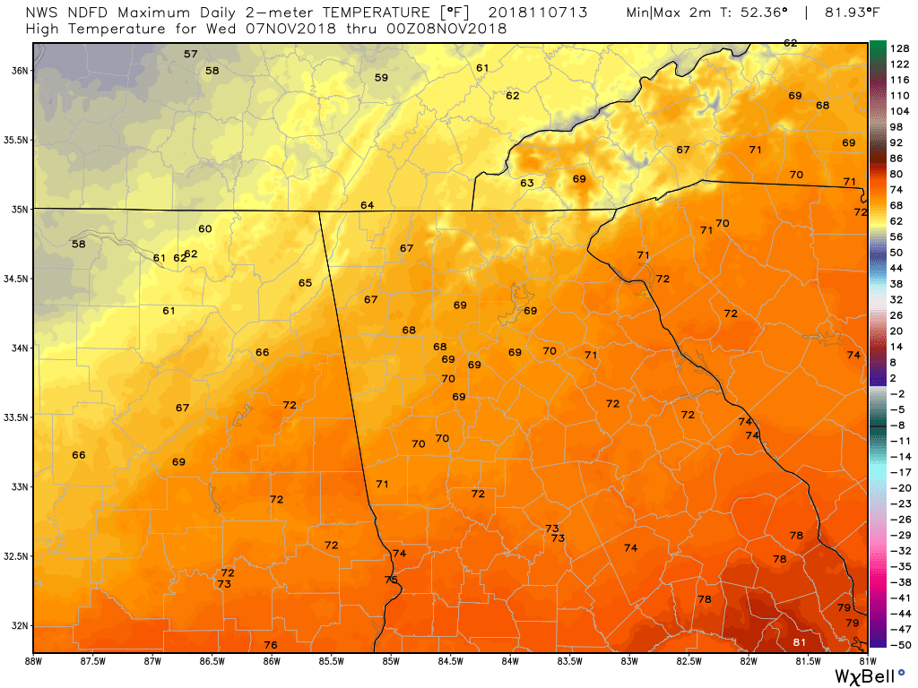
High Temps Today
|
TEMPERATURE ANOMALIES
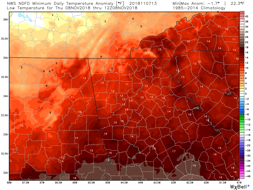
Low Temp Anomalies This Morning
|
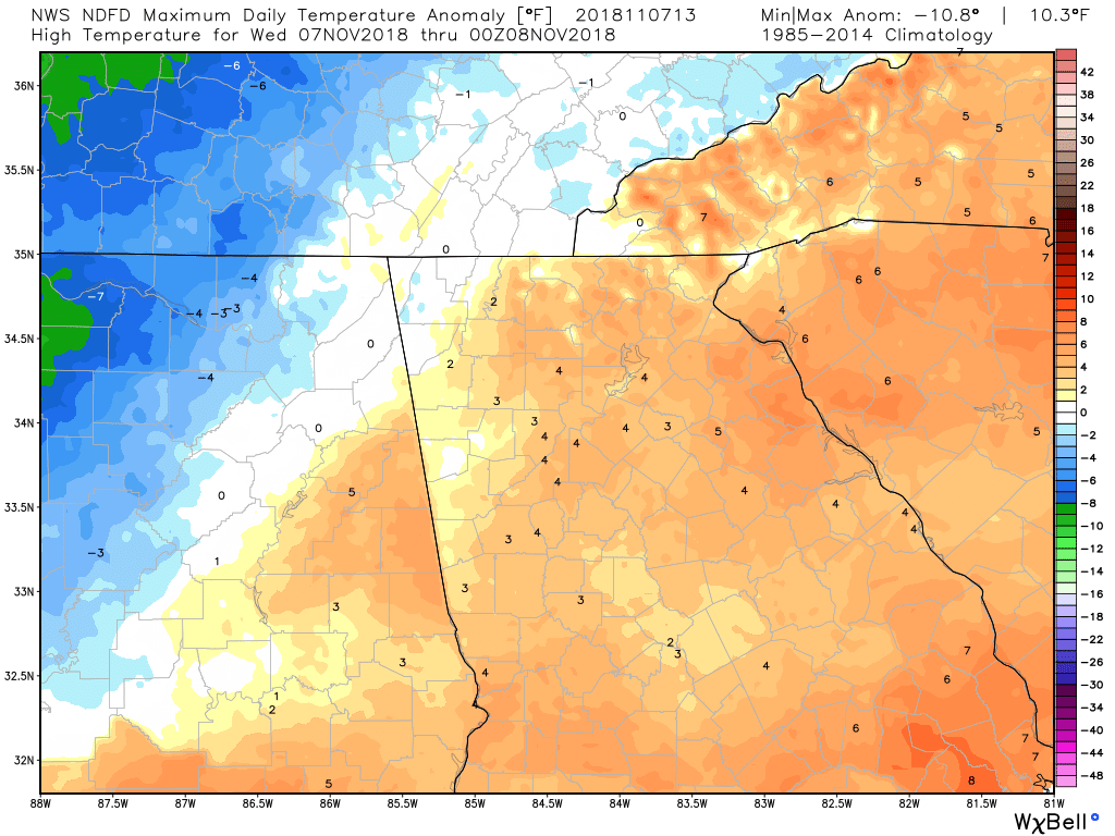
High Temp Anomalies Today
|
WIND
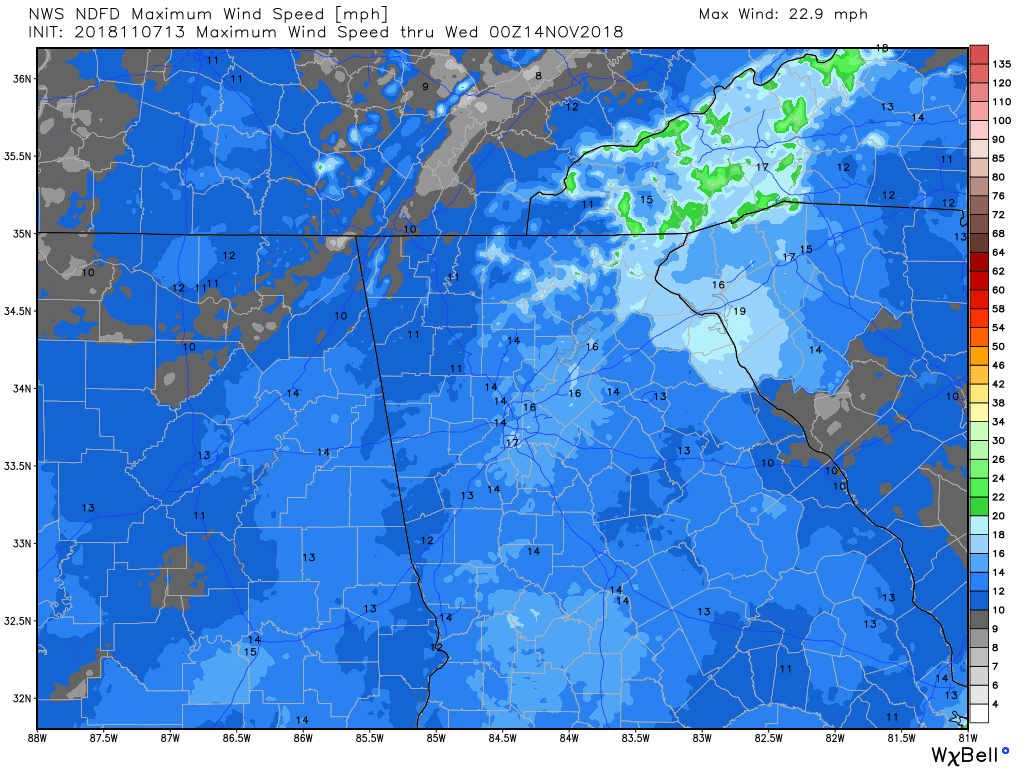
Max Wind Speed
|
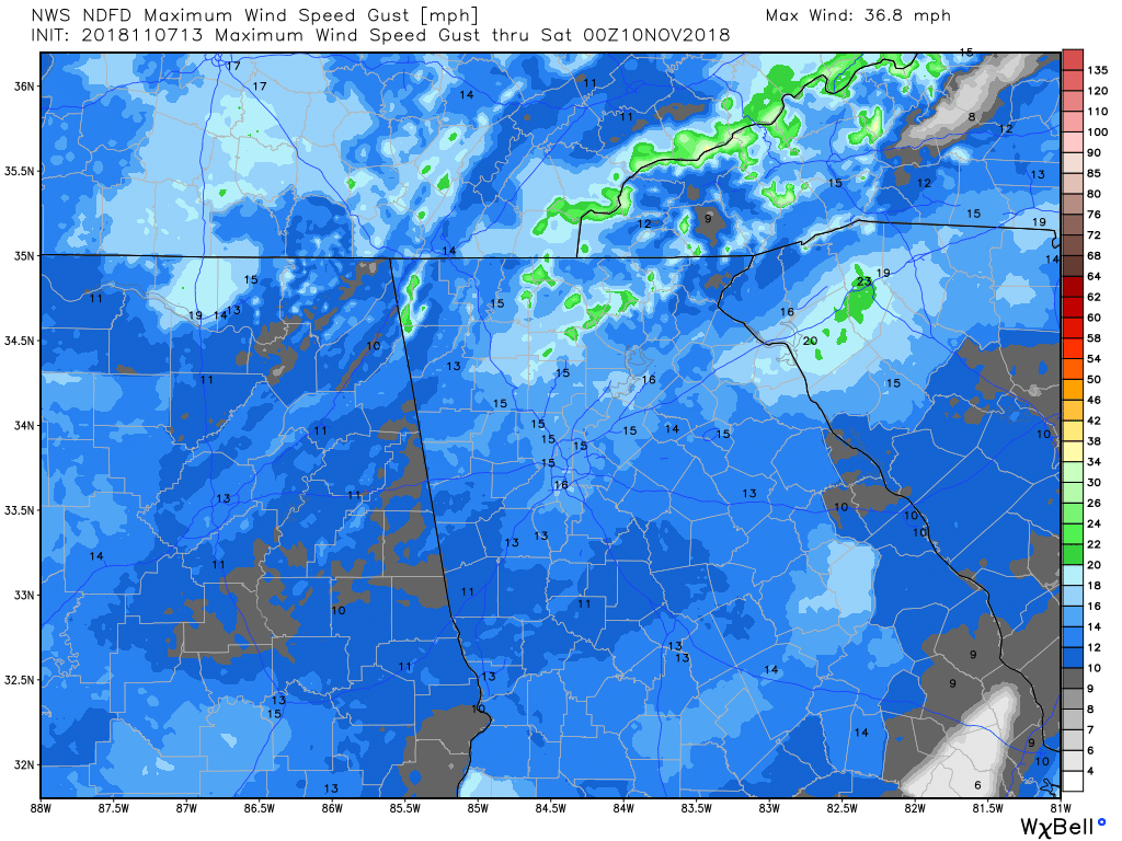
Max Wind Gust
|
PRECIPITATION
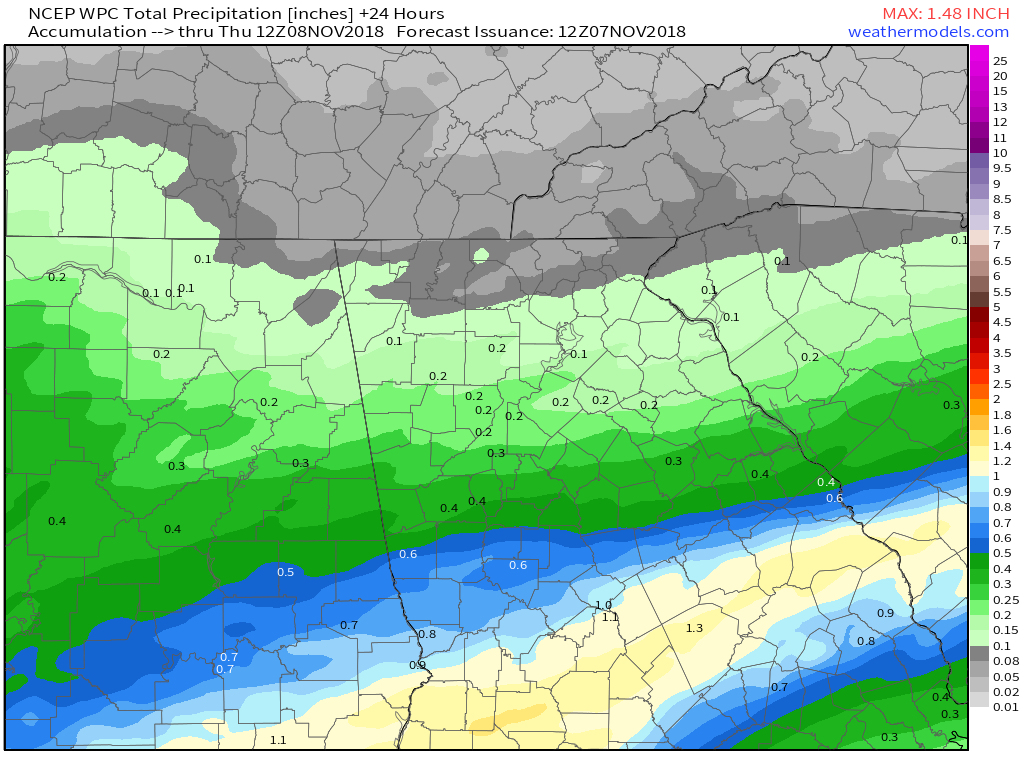
WPC - 24 Hour Precipitation Forecast
|
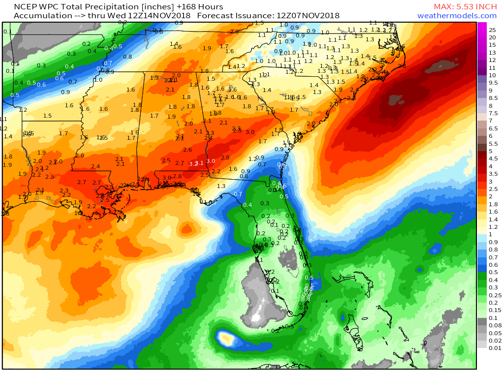
WPC - 7 Day Precipitation Forecast
|
0 Comments
Recommended Comments
There are no comments to display.