

Weather on This Date - December 1 - Start of Meteorological Winter

Entry posted by NorthGeorgiaWX
1,296 views
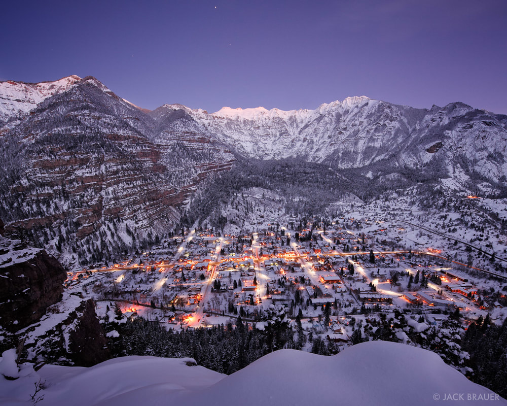 https://www.mountainphotography.com/photo/winter-twilight-over-ouray/
December 1, 1831
The coldest December of record in the northeastern U.S. commenced. Temperatures in New York City averaged 22 degrees, with just four days above freezing, and at Burlington VT the temperature never did get above freezing. The Erie Canal was closed the first day of December, and remained closed the entire month. (David Ludlum)
December 1, 1896
The temperature at Kipp, MT, rose 30 degrees in just seven minutes, and 80 degrees in a matter of a few hours. A thirty-inch snow cover was melted in half a day. (The Weather Channel)
December 1, 1913
A six day front range snowstorm began. It produced a record total of 46 inches at Denver CO. (David Ludlum)
December 1, 1985
A storm produced more than six inches of snow from the Northern and Central Plains to parts of Michigan, with 36.4 inches reported at Marquette MI. Many roads were blocked by snow. A family was stranded for 25 hours south of Colome SD. Drifts twelve feet high were reported in north central Nebraska. (The Weather Channel)
December 1, 1987
A powerful storm hit the northwestern U.S. Winds gusted to 80 mph at Cape Disappointment WA, and reached 94 mph at Cape Blanco OR. Thunderstorms in western Washington State produced wind gusts to 60 mph, and dime size hail at Hoquiam. Stevens Pass, in the Cascade Mountains of Washington, received seven inches of snow during the morning hours. (The National Weather Summary) (Storm Data)
December 1, 1988
Squalls in the Great Lakes Region produced up to a foot of snow in Ashtabula County OH, up to ten inches in Erie County PA, and up to a foot of snow in western New York State. (Storm Data) (The National Weather Summary)
December 1, 1989
Heavy snow blanketed the mountains of New Mexico, with 12 inches reported at the Angel Fire Ski Basin. Strong northerly winds ushering cold air into the north central U.S. gusted to 55 mph at Devils Lake ND. Low pressure over the Gulf of Alaska produced wind gusts to 69 mph at Kodiak Island. (Storm Data) (The National Weather Summary)
December 1, 2002
Heavy lake effect snow fell downwind of the U.S. Great Lakes. Buffalo, New York reported 16 inches of snow, with thundersnow reported late in the afternoon. While the eastern U.S. experienced much colder than normal temperatures on December 1, much of Alaska was basking in above average warmth. Many daily temperature records were set across this region through the beginning of the month.
December 1, 2007
During December 1-3, a powerful storm with hurricane force winds struck the Northwest U.S. The storm brought heavy rain and wind gusts over 100 mph, with the highest reading being 129 mph at Bay City, OR. The strong winds brought power lines down, and the heavy rain caused widespread flooding and triggered landslides (BBC News). According to reports, 8 fatalities were attributed to the storm and about 37,000 homes and businesses were left without power in Washington, Oregon, and northern California. President Bush declared a federal disaster in several counties in Washington and Oregon to provide recovery assistance (Associated Press).
December 1, 2011
Wind speeds as high as 102 MPH were measured in Centerville, Utah and surrounding cities. Damage was reported throughout Weber and Davis counties ranging from South Ogden down to Bountiful. More than 400 trees were down at the Davis Golf course alone due to the winds. Up to 54,000 residences were without power throughout the day and into the evening. Train service between Layton and Salt Lake City was suspended due to damaged train stations, debris on the train tracks, and power outages. Cleanup costs totaled $8 million in Centerville alone. No injuries were reported from the wind, but a number of injuries were reported from those helping with the cleanup effort.
Data courtesy of WeatherForYou
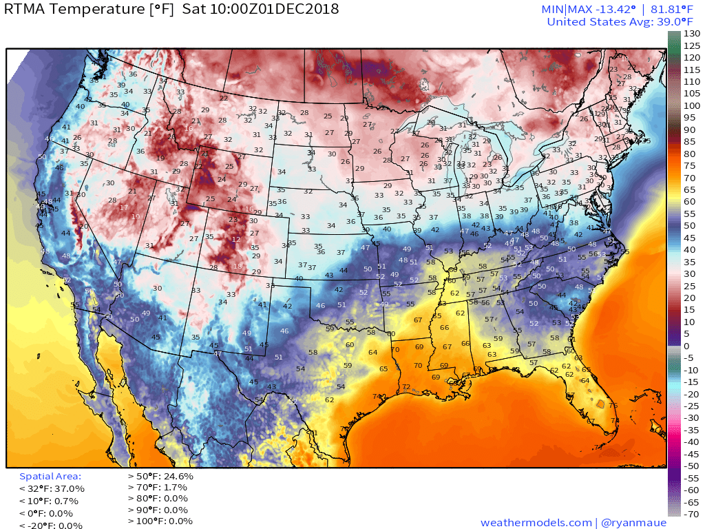
TODAY'S WEATHER SUMMARY
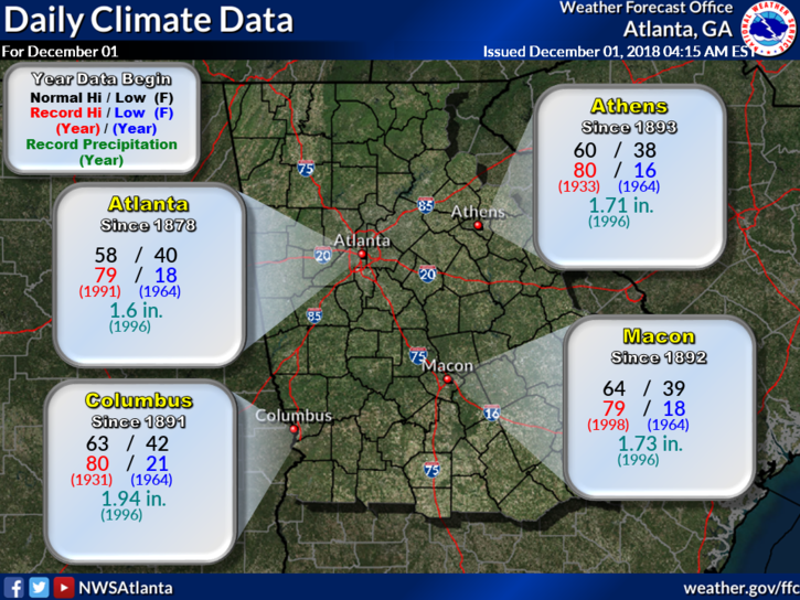
Today's Climate Records and Averages
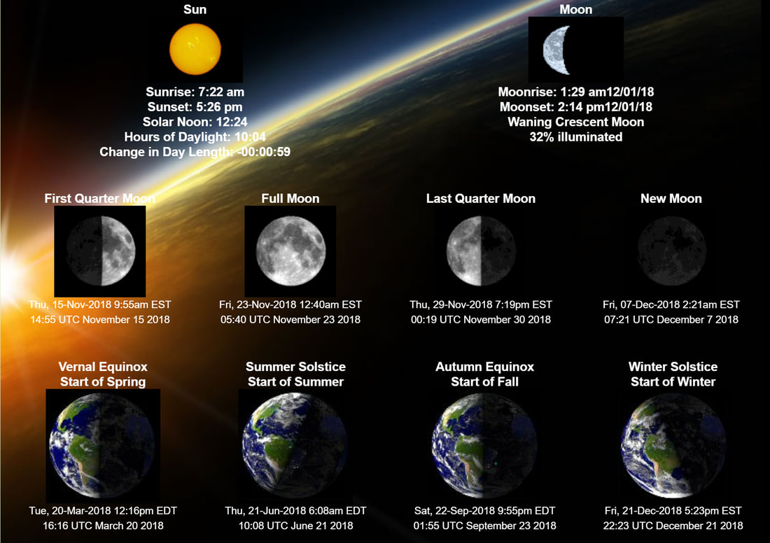
Astronomical Information for Today - Accurate for Gwinnett County GA
5:00 AM TEMPS, EW POINTS, WIND CHILL, and TEMP CHANGE
 Temperatures | 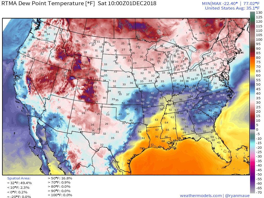 Dew Points |
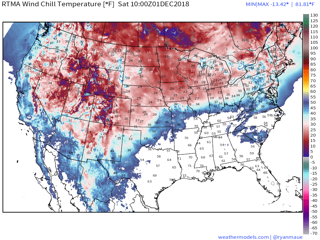 Wind Chill | 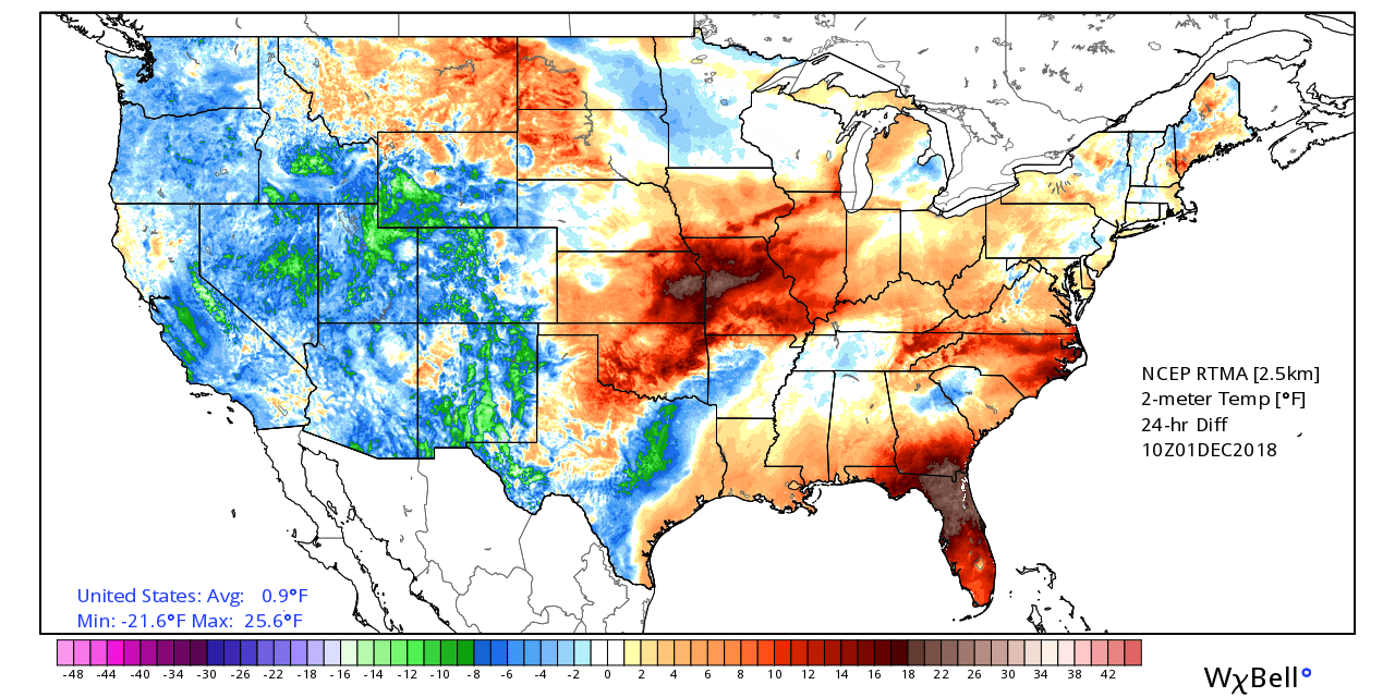 24 Hour Temp Change |
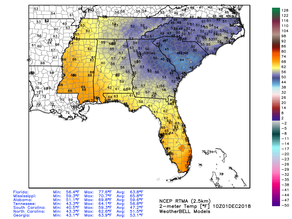
5 am Southeast Temperatures
TODAY'S FORECAST
TEMPERATURES
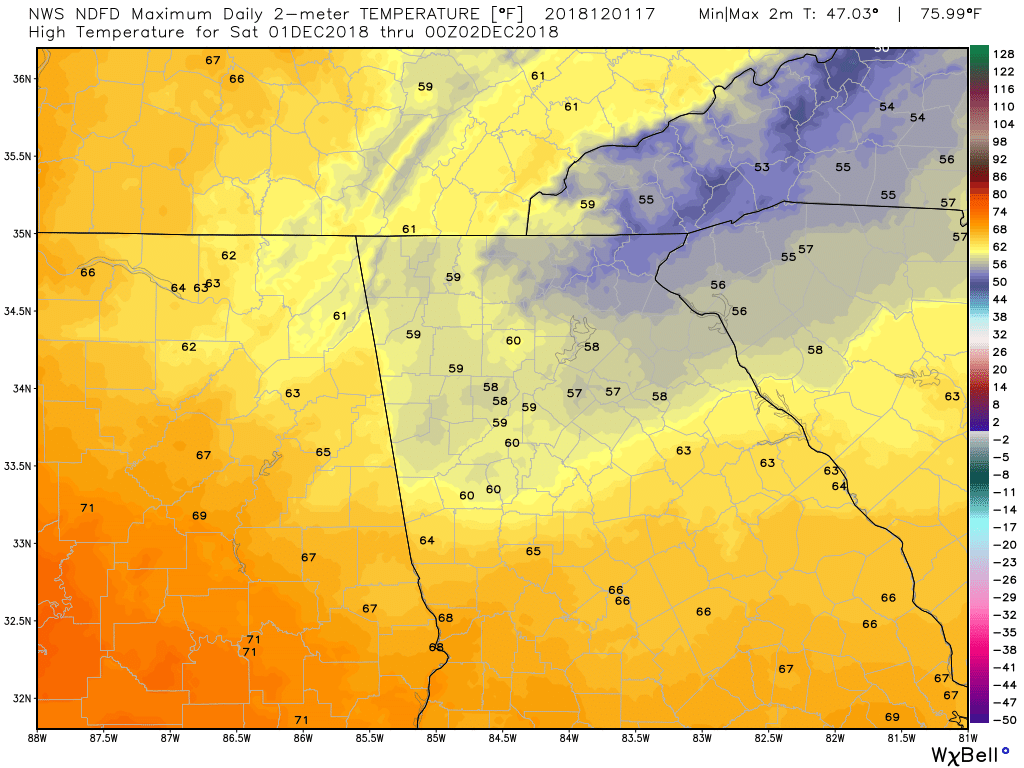 High Temps Today | 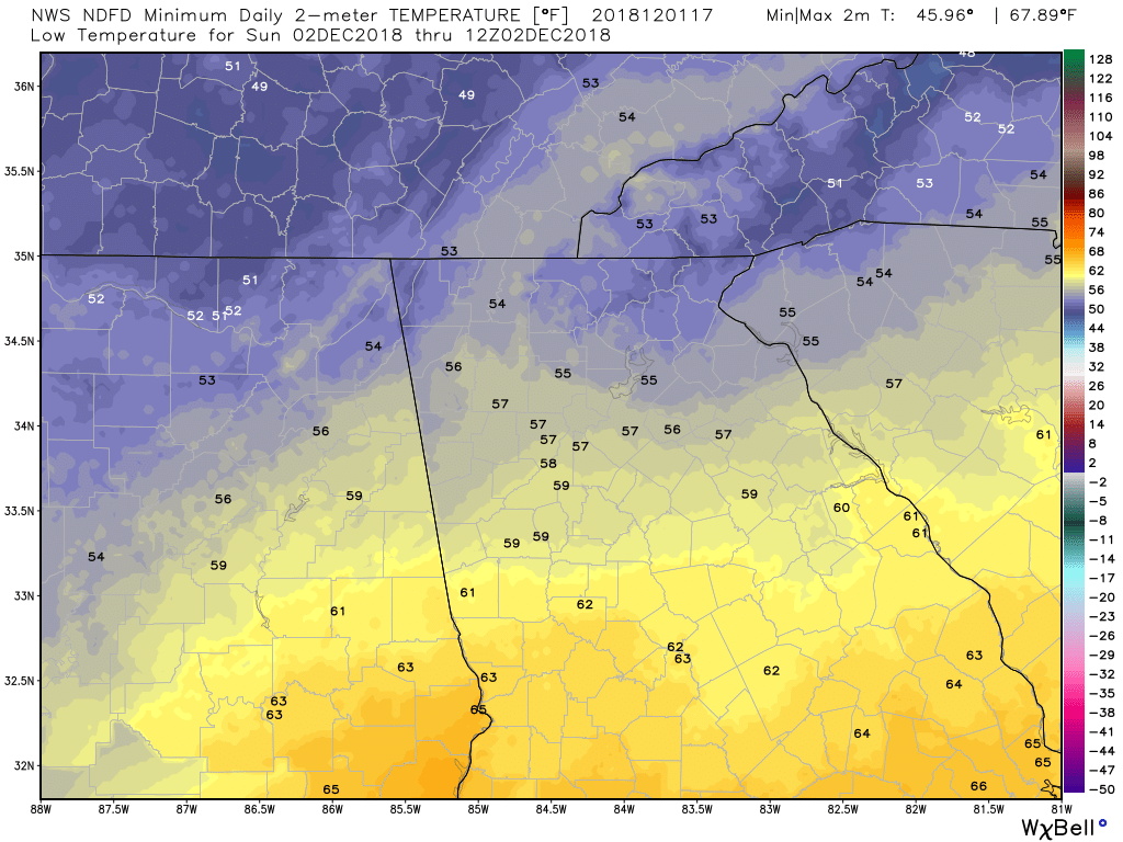 Low Temps Tomorrow Morning |
TEMPERATURE ANOMALIES
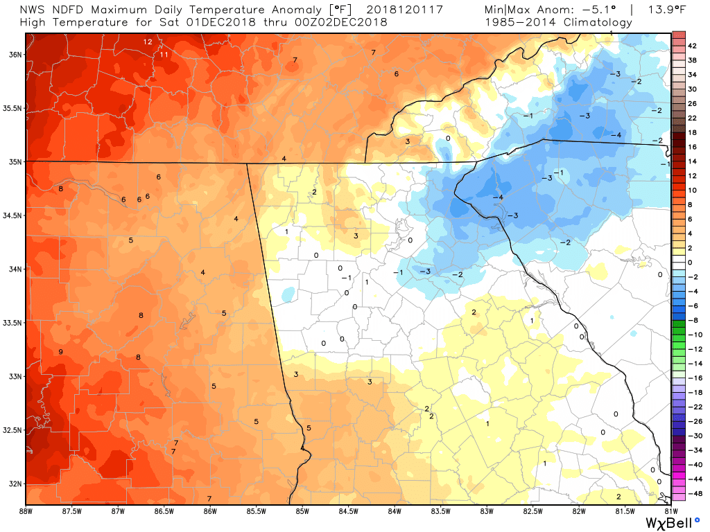 High Temp Anomalies Today | 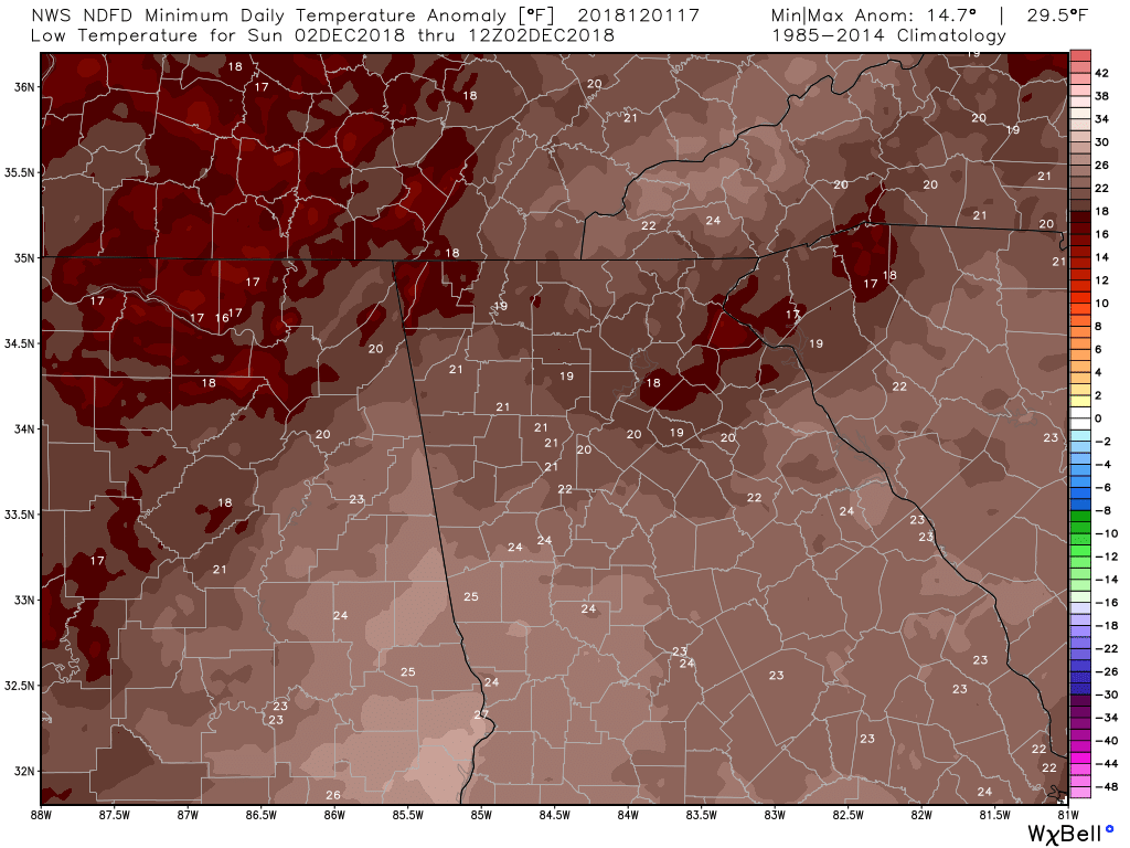 Low Temp Anomalies Tomorrow Morning |
WIND
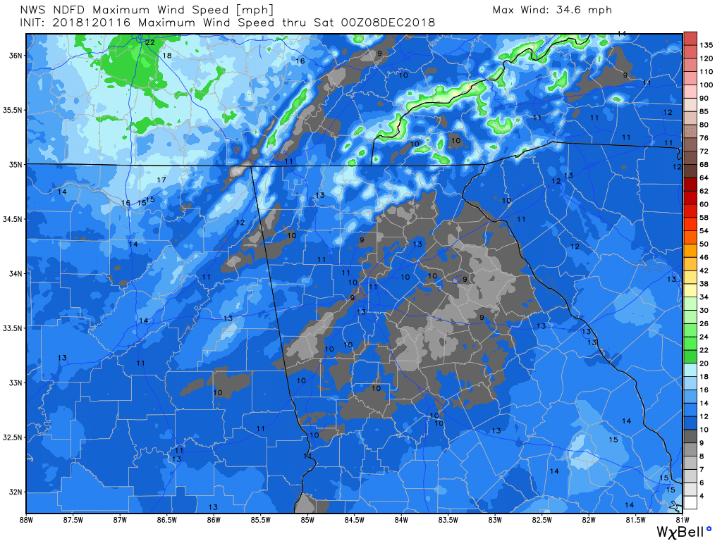 Max Wind Speed | 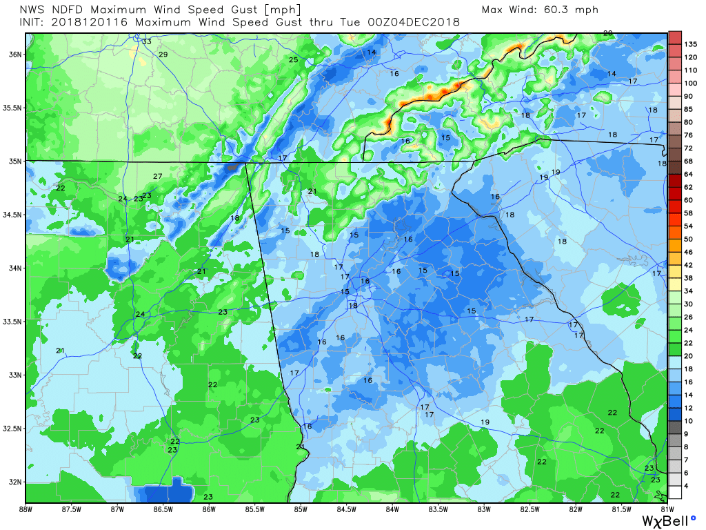 Max Wind Gust |
PRECIPITATION
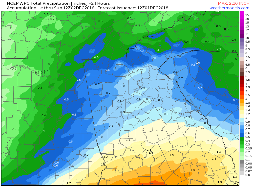 WPC - 24 Hour Precipitation Forecast | 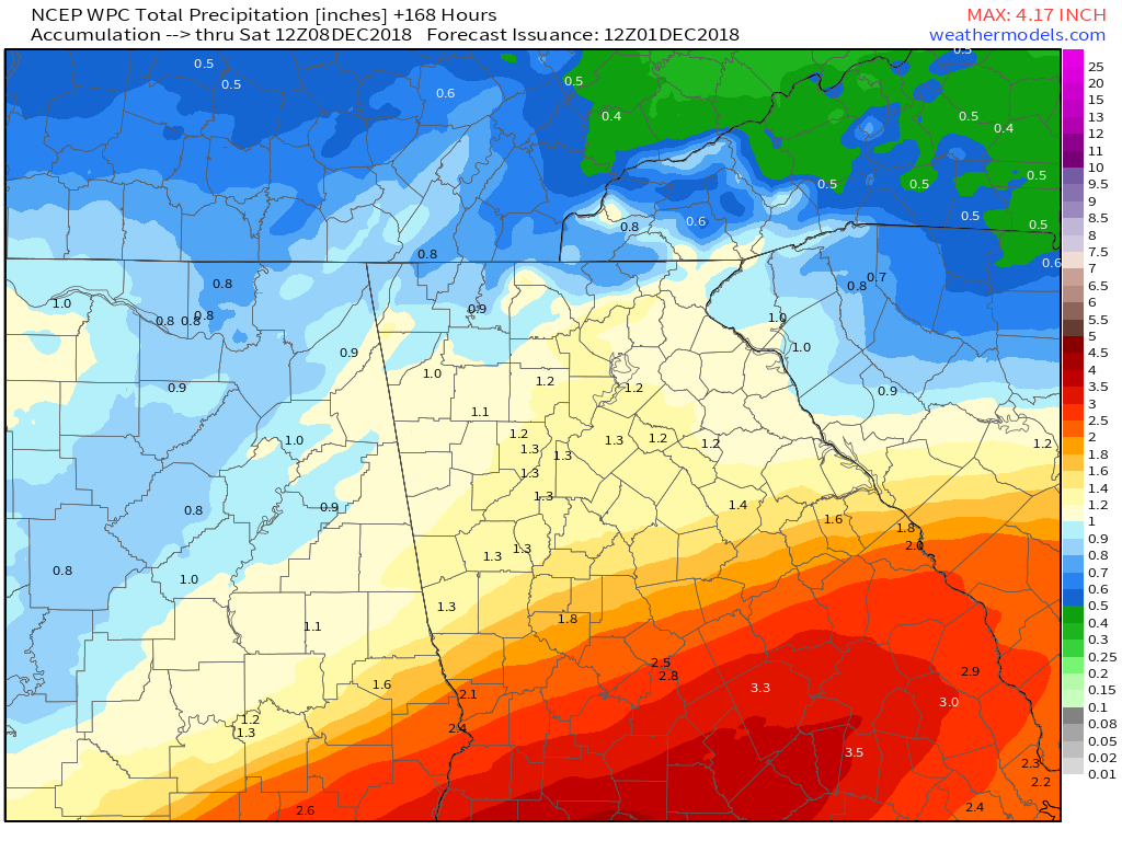 WPC - 7 Day Precipitation Forecast |
SNOW
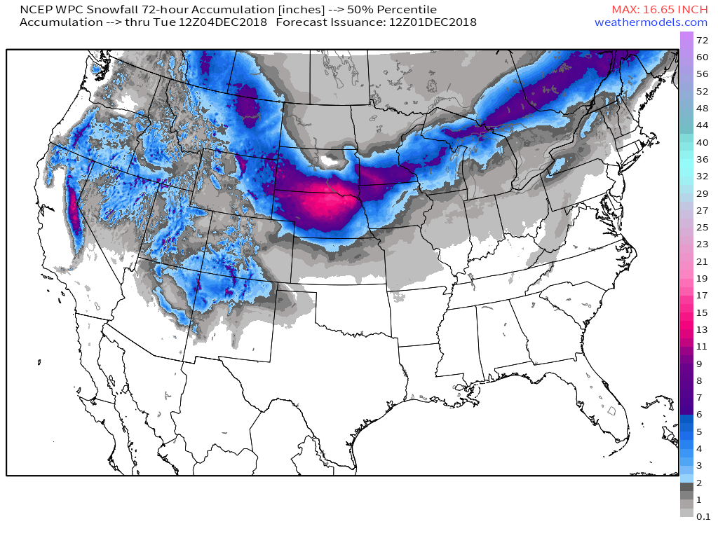
WPC 72 Hour Snow Forecast
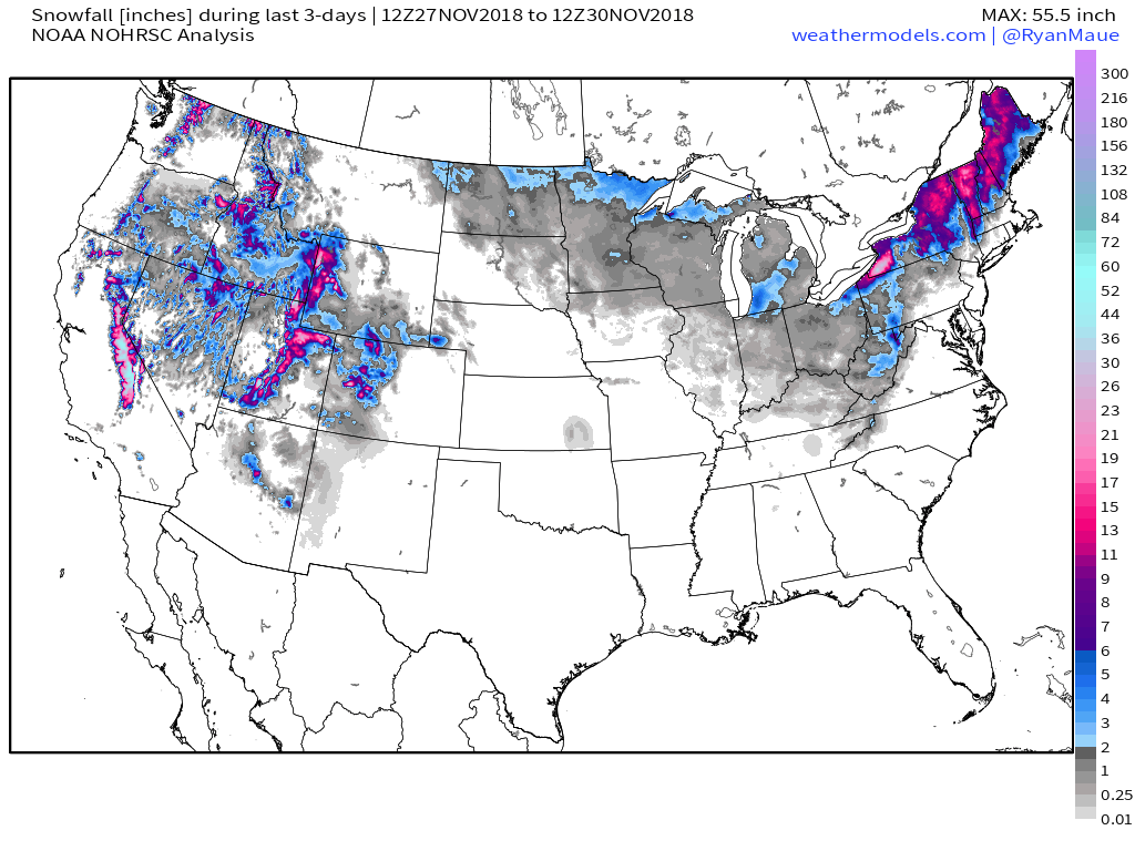 Last 3 Days Snowfall | 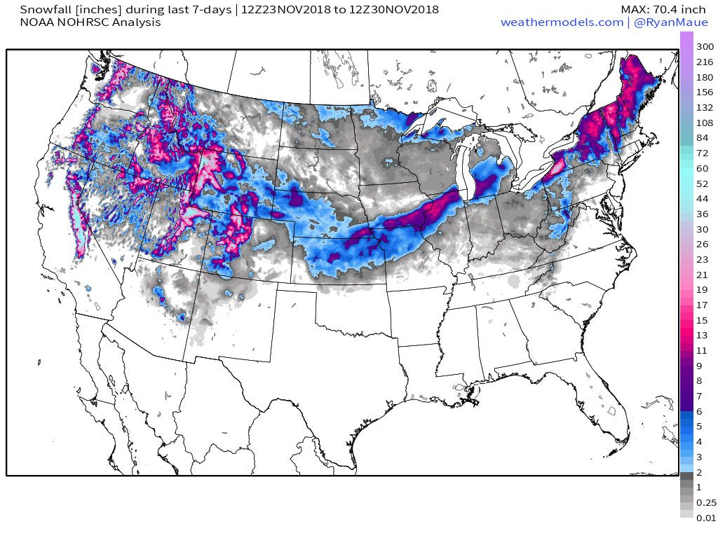 Last 7 Days Snowfall | 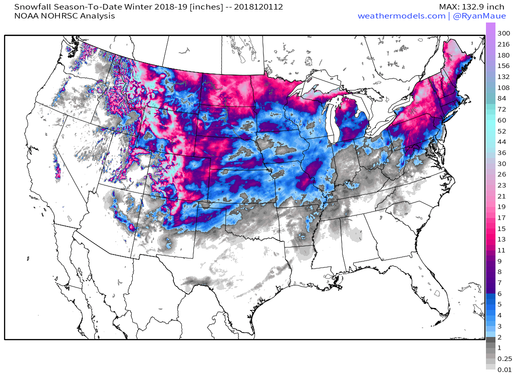 Season to Date |
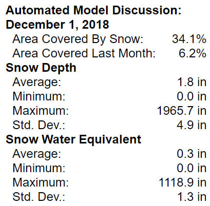 Snow Cover on This Date | 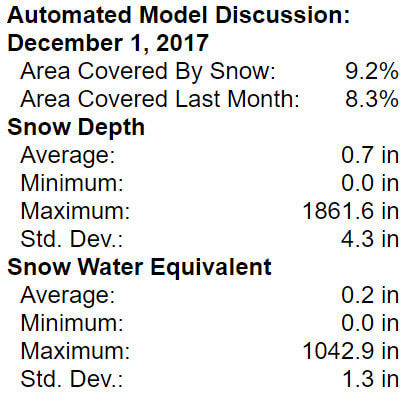 Snow Cover on This Date Last Year |
0 Comments
Recommended Comments
There are no comments to display.